Introduction: Why Agricultural Drones Matter Right Now
Farming has never faced more pressure. Rising input costs, extreme weather, and shrinking labor pools are forcing growers to do more with less. Agricultural drones — also called farm drones or precision agriculture drones — are rapidly becoming the tool that closes that gap.
Whether you manage a 5-acre smallholding or a 5,000-acre grain operation, agricultural drones offer a practical path to better decisions, lower costs, and higher yields. This guide covers everything a beginner needs to know: what these machines are, how they work, what they cost, and where the technology is heading in 2026.
Whether you plan to buy your own equipment or use agricultural drone services available for US farmers, this guide gives you the foundation by the end, you will understand why agricultural drones are one of the fastest-growing tools in modern farming — and whether they make sense for your operation.
What Are Agricultural Drones?
An agricultural drone is an unmanned aerial vehicle (UAV) designed or adapted for use on farmland. Unlike consumer drones built for photography or recreation, farm drones carry specialized sensors, spraying systems, or mapping software tuned to crop production.
They can be fixed-wing (like a small aircraft) or multirotor (the familiar quad- or hex-copter shape). Most operate semi-autonomously: a farmer plots a field boundary on a tablet, and the drone flies the mission on its own, collecting data or applying inputs with minimal manual input.
The term ‘agricultural drone’ covers a wide family of devices — from a lightweight mapping unit that fits in a backpack to a heavy-lift sprayer that carries 20 litres of crop protection product. What unites them is their ability to gather aerial intelligence or deliver precise applications that would take ground equipment far longer to complete.
Types of Agricultural Drones: The Hub Overview
Understanding the main categories helps you match the right tool to your farming challenge. Each type is explored in depth in a dedicated post — use the links below to go deeper.
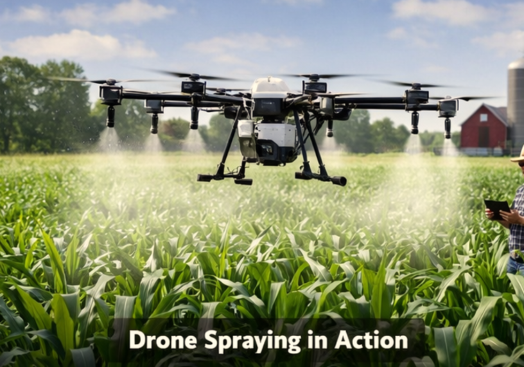
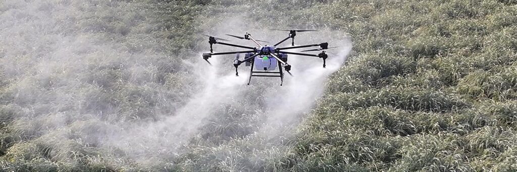
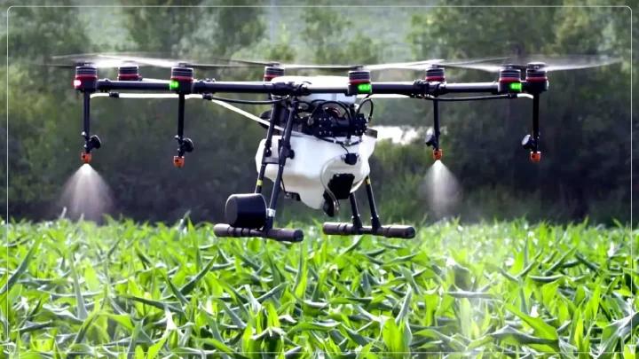
1. Crop Spraying Drones
These heavy-lift multirotor drones carry tanks of liquid fertiliser, pesticide, or fungicide and deliver ultra-low-volume applications with GPS precision. They are especially valuable on hilly terrain, wet fields, or rice paddies where ground rigs cannot operate.
If spraying is your primary need, we’ve covered the benefits of drone crop spraying for efficiency and cost savings in detail including real numbers from US farms.
2. Crop Monitoring & Multispectral Drones
Fitted with cameras that see beyond the visible spectrum (near-infrared, red-edge), these drones detect crop stress, nitrogen deficiency, and disease weeks before symptoms are visible to the naked eye. The result is faster, cheaper scouting across large acreages.
Multispectral analysis is explained in detail — including how NDVI scores are generated and used — in our guide to crop health monitoring with drones using NDVI.
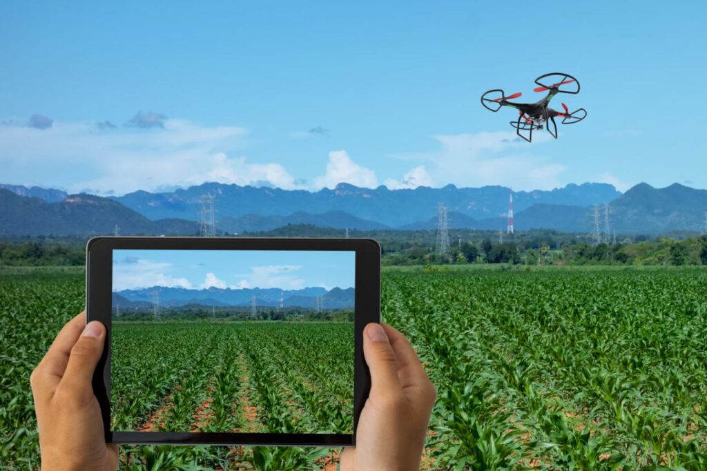
3. Mapping & Survey Drones
Fixed-wing or multirotor units equipped with high-resolution RGB cameras create detailed orthomosaic maps, digital elevation models, and plant population counts. Agronomists and farm managers use these maps for drainage planning, variable-rate prescription maps, and yield correlation analysis.
The step-by-step flight-to-map process is fully explained in our guide on how drone mapping works for farms step by step.
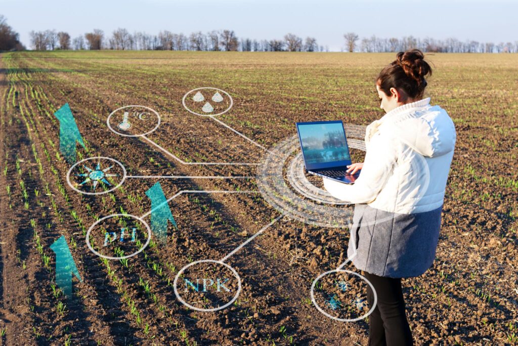
4. Soil Sampling & Analysis Drones
Emerging platforms can carry lightweight sampling probes or combine aerial imagery with ground sensor networks to produce high-resolution soil maps. These reduce the number of physical samples needed while increasing spatial resolution.
5. Seeding & Spreading Drones
Originally developed for direct seeding into flooded rice fields, these drones now spread cover crop seed, biocontrol agents, and granular fertiliser. They are gaining traction in reforestation and regenerative agriculture contexts.
How Agricultural Drones Work: A Simple Overview
Most agricultural drone workflows follow four repeatable phases. A separate guide walks through each in technical detail — here is the plain-language version.
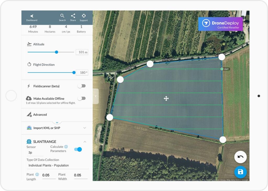
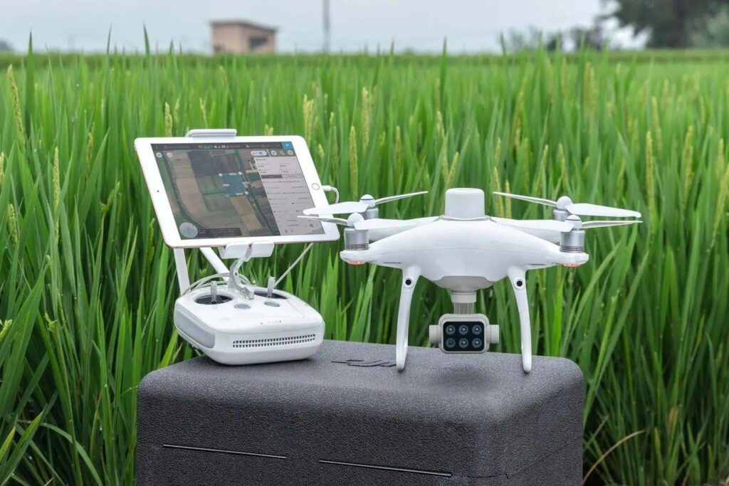
Step 1: Mission Planning
The farmer or agronomist opens a tablet app and draws the field boundary. The software calculates an automated flight path, sets altitude, speed, and overlap percentage, and estimates battery usage. For spraying missions, the application rate per hectare is set at this stage.
Step 2: Pre-Flight & Calibration
The drone’s sensors and GPS are calibrated. Tanks are filled (for spraying) or the camera payload is confirmed. Most modern drones run an automated pre-flight check that alerts the operator to low battery, compass errors, or sensor faults before takeoff.
Step 3: Autonomous Flight & Data Collection
The drone executes the planned route without constant input. RTK (real-time kinematic) GPS keeps position accurate to within 2–3 centimetres. Sensors collect imagery or the spraying system applies product at the programmed rate as the aircraft moves across the field.
Step 4: Data Processing & Action
For mapping drones, images are stitched into orthomosaics using cloud or desktop software (Pix4D, DJI Terra, Agisoft Metashape). NDVI and other vegetation indices are calculated, generating prescription maps that guide variable-rate applications. Spraying missions typically need no post-processing — the work is done in the field.
For a practical breakdown of exactly how these four steps play out on a real farm, see our guide on how drone technology actually works in real farm conditions
Key Benefits of Agricultural Drones
The adoption curve for agricultural drones is steep because the returns are measurable. Here are the benefits that matter most to farmers.
Faster Field Coverage
A spraying drone can cover 10–15 hectares per hour — roughly 40–60 times faster than a backpack sprayer and competitive with ground rigs on difficult terrain. Mapping drones can survey hundreds of hectares in a single charge.
Precision Application = Lower Input Costs
Variable-rate technology ensures product is placed only where it is needed, at the exact rate the prescription map specifies. Studies consistently show input savings of 20–30% versus uniform-rate application, with no loss of efficacy.
Early Problem Detection
Multispectral imagery catches stress signals — nutrient deficiency, waterlogging, pest pressure — an average of 7–14 days before visible symptoms appear. Early intervention is almost always cheaper than late-stage remediation.
Access to Difficult Areas
Steep slopes, wet headlands, waterlogged paddocks, and inaccessible areas between greenhouses are no obstacle for drones. This extends precision management to parts of the farm previously treated by guesswork or skipped entirely.
Data-Driven Decision Making
Every mission generates a record — GPS logs, application maps, imagery time-series — that supports agronomic decisions, insurance claims, and regulatory compliance. Over seasons, this data becomes a valuable farm intelligence asset.
Reduced Chemical Load on the Environment
Targeted spraying reduces off-target drift and runoff compared to broadcast application. For farms working toward sustainability certifications, drone records provide an audit trail of reduced chemical use.
Real-World Use Cases Across Farm Types
Agricultural drones are no longer just a tool for large-scale commodity production. The technology has matured to the point where practical applications exist across farm sizes and enterprise types.
Broad-Acre Grain Farming
Wheat, corn, and soybean producers use mapping drones for canopy analysis and variable-rate nitrogen prescription. Spraying drones handle fungicide and insecticide applications at flowering when weather windows are short and ground traffic risks compaction.
To see how farmers across different operations are actually deploying this technology, read our detailed breakdown of real farming use cases for agricultural drones.
Horticulture & Tree Crops
Orchards and vineyards use multispectral drones to map canopy density, identify disease hotspots, and calculate fruit load estimates before harvest. Spraying drones navigate between rows to deliver precision foliar nutrition.
Rice & Flooded-Field Crops
Drone spraying was first commercialised at scale in Japanese and Chinese rice production. Flooded conditions make ground rigs impractical; drones solve this entirely and are now standard practice in large rice-producing regions.
Small & Medium Farms
Drone service providers (agronomists or contractors who own drones and offer hourly or per-hectare rates) make the technology accessible without capital outlay. A 50-hectare vegetable grower can commission a scouting flight for less than the cost of a day’s manual scouting labour.
Cost Overview: What Do Agricultural Drones Cost?
Cost is one of the first questions every farmer asks, and the honest answer is: it depends on the category. Entry-level mapping drones start around $2,000–$5,000 USD. Mid-range multispectral units sit in the $10,000–$25,000 range. Professional spraying platforms capable of carrying 20+ litre tanks typically cost $15,000–$30,000 or more, plus annual support contracts.
The main cost factors are payload capacity, sensor quality, RTK GPS precision, battery autonomy, and software ecosystem. Regulatory compliance (operator licences, insurance) adds to the total cost of ownership.
For many operators — especially on smaller farms — hiring a drone service provider is more economical than ownership. Service rates typically run $5–$20 per hectare for spraying and $2–$8 per hectare for mapping, varying by region and mission complexity.
We’ve put together a comprehensive breakdown of agricultural drone service costs and pricing per acre to help you compare hiring vs owning.
Challenges and Limitations to Know
Agricultural drones are impressive tools, but they come with real constraints. Understanding them upfront prevents costly misjudgements.
- Regulatory hurdles: Most countries require operator certification and specific approvals for beyond-visual-line-of-sight (BVLOS) flight or spraying missions. Regulations vary widely and change frequently.
We’ve covered FAA regulations for agricultural drone operators in the USA in full, including Part 107 requirements and what spraying operators specifically need.
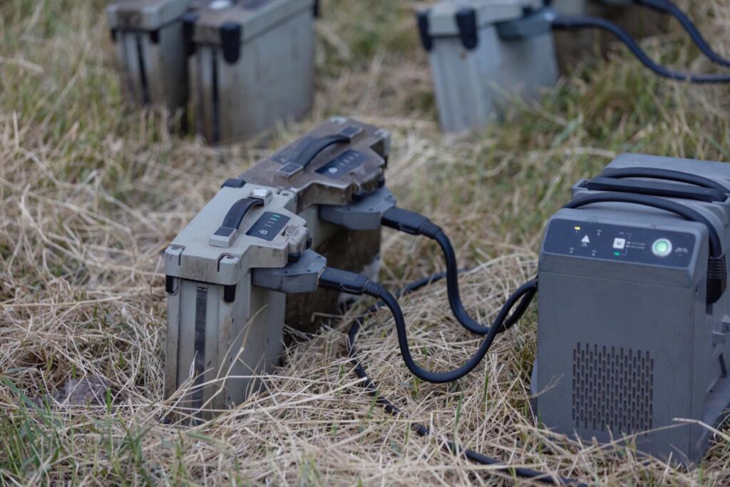
- Battery limits: Even high-capacity spraying drones typically fly 10–20-minute missions before needing a battery swap or charge. Large fields require either multiple batteries or a charging station nearby.
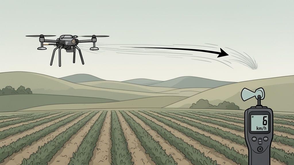
- Weather sensitivity: Strong winds (above 7–10 m/s for most platforms), rain, and extreme temperatures ground drones. Planning must account for narrow weather windows, especially during critical crop growth stages.
- Data management overhead: Mapping missions generate gigabytes of imagery that require processing time, software licences, and agronomic expertise to interpret correctly.
- Upfront investment: Quality agricultural drones are not cheap. ROI calculations matter, and the payback period depends heavily on farm size, crop value, and how intensively the equipment is used.
The Future of Agricultural Drones: What’s Coming
The trajectory of agricultural drone technology points toward greater autonomy, deeper integration, and lower cost per hectare.
AI-Powered Crop Intelligence
Machine learning models trained on millions of field images can now identify 50+ crop diseases, pest species, and nutrient deficiencies directly from drone imagery — often faster and more accurately than experienced agronomists. These tools are moving from research labs to commercial apps in 2025–2026.
Swarm Operations
Multiple drones operating in coordinated swarms can cover thousands of hectares per day. Swarm technology is already in commercial trials in China and is expected to reach western markets within the next two to three years.
Integration with Farm Management Systems
Drone data platforms are connecting directly to ERP systems, variable-rate controllers, and precision irrigation systems. The vision is a closed-loop system where a drone flight automatically generates and executes a prescription — no manual intervention required.
Longer Range & Heavier Payloads
Advances in battery energy density and hybrid power systems are extending flight time and payload capacity. Fixed-wing VTOL (vertical take-off and landing) hybrids are emerging as a solution for large-scale operations that need both endurance and spraying capability.
Final Thoughts
Agricultural drones are not a silver bullet, and they are not a gimmick. They are a mature, rapidly improving category of precision agriculture tools with a clear and growing evidence base behind them.
For farmers willing to invest time in understanding the technology — or to work with a qualified service provider — the returns are real: lower input costs, earlier problem detection, better data, and access to parts of the farm that were previously difficult to manage precisely.
Whether you are considering your first scouting flight or evaluating a full spraying platform, the pages linked throughout this guide will take you from overview to informed decision. Start with the type that matches your most pressing challenge, and build from there.
Frequently Asked Questions
Q: Do I need a licence to fly an agricultural drone?
A: In most countries, yes — commercial drone operations (including spraying) require an operator licence and often specific airspace approvals. Requirements vary by country; always check with your national aviation authority before purchasing.
Q: How much land do I need to make agricultural drones worthwhile?
A: As a rough guide, spraying drones typically become cost-competitive with conventional equipment at 50+ hectares per season. Mapping services deliver ROI at much smaller scales — even 5–10 hectares of high-value horticulture can justify a scouting flight.
Q: Can drones replace traditional sprayers?
A: Not entirely, but they complement them well. Drones excel in difficult terrain, tight weather windows, and targeted applications. Ground rigs remain more efficient for large-scale uniform applications on flat, accessible fields.
Q: How accurate are agricultural drone spray applications?
A: Modern RTK-GPS spraying drones achieve positioning accuracy of 2–3 cm, with flow controllers that maintain application rate within ±2–5% of the target. This is comparable to or better than most tractor-mounted precision sprayers.
Q: What crops are best suited to agricultural drones?
A: Drones are used across virtually all crop types. Spraying drones are especially valuable in rice, vegetables, fruit, and viticulture. Mapping drones deliver the most value in broad-acre crops like wheat, corn, canola, and soy where scale amplifies the ROI.
Q: What is NDVI and why does it matter?
A: NDVI (Normalised Difference Vegetation Index) is a calculation derived from multispectral imagery that measures crop canopy health. Higher NDVI values indicate healthy, dense canopies; lower values flag stress. It is the most widely used metric from drone-based crop monitoring.