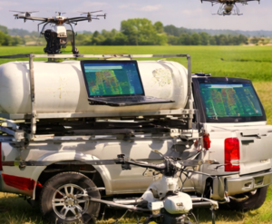
Tday the modern farmers are increasingly relying on Agricultural Drone Technology to improve efficiency, reduce costs, and monitor crops more accurately. Drones provide a bird’s-eye view of fields, enabling faster decisions and targeted interventions. By automating tasks like crop spraying and mapping, drones are transforming everyday farming operations.
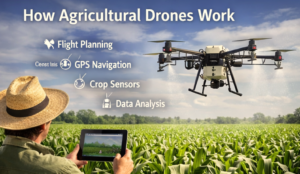
How Agricultural Drones Work
Drones in agriculture combine sensors, GPS, and automated flight systems to perform key tasks. Here’s how they function in a typical farm workflow:
| Step | Action | Purpose |
|---|---|---|
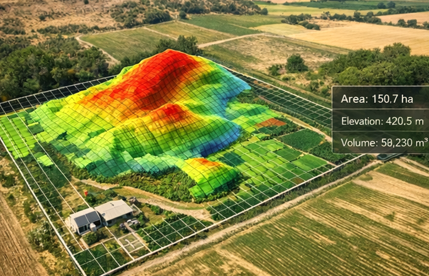
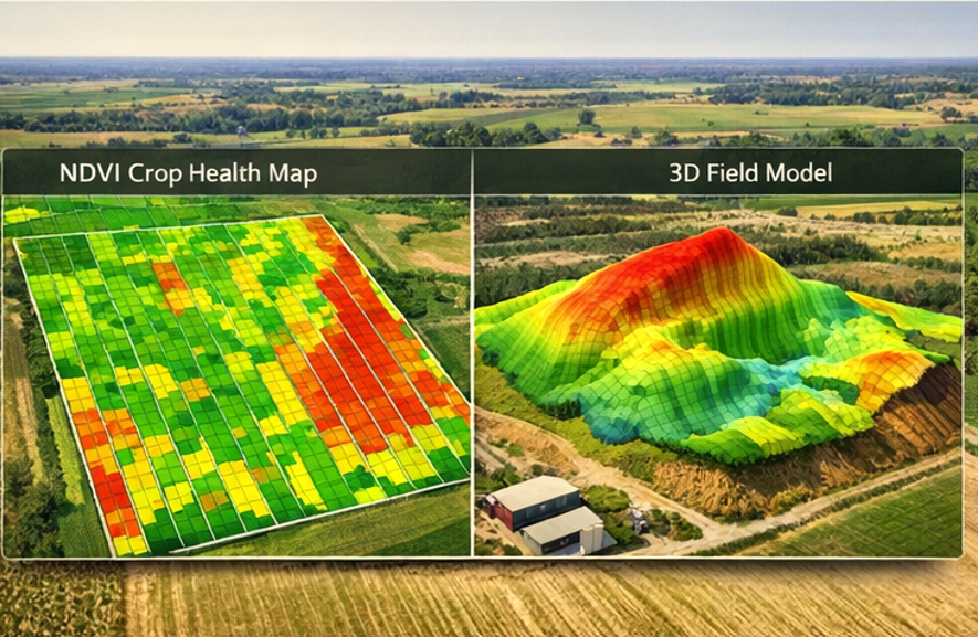
| Field Analysis | Drone scans fields using cameras or multispectral sensors | Detects crop health, stress, and irrigation needs |
| Flight Planning | Software plots drone flight path | Ensures full field coverage efficiently |
| Automated Mission | Drone flies autonomously over crops | Collects data or applies pesticides/fertilizers precisely |
| Data Analysis | Collected images are processed into maps and reports | Supports informed farm management decisions |
This workflow allows farmers to make decisions quickly and accurately.
Types of Agricultural Drones
Farmers choose drones based on specific tasks:
| Drone Type | Features | Farming Use |
|---|---|---|
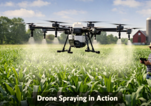
| Crop Spraying Drones | Large tanks, automated nozzles | Targeted spraying reduces chemical waste |
| Aerial Mapping Drones | High-resolution cameras, GPS mapping | Produces detailed field maps for planning |
| Multispectral Imaging Drones | NIR and thermal sensors | Detects disease, nutrient deficiencies, and water stress |
Each type addresses a practical farming need and can be combined for full-field monitoring.
Real Farming Applications
Farmers use drones to tackle everyday challenges:
- Early Disease Detection – Drones spot stressed plants before visible symptoms, allowing rapid intervention.
- Precision Spraying – Targeted application of fertilizers and pesticides reduces waste and cost.
- Irrigation Management – Aerial maps reveal soil moisture patterns to optimize watering schedules.
These applications lead to healthier crops, better yields, and lower operational costs.
Benefits for Farmers
Drones improve farming efficiency in several ways:
| Benefit | Explanation |
|---|---|
| Labor Savings | One operator can manage drone missions that would take several workers |
| Cost Reduction | Precision spraying decreases chemical and water usage |
| Improved Monitoring | Detailed aerial data helps identify issues early, preventing losses |
| Faster Decision-Making | Real-time insights speed up farm management actions |
Limitations and Challenges
Even with benefits, drones face some practical limitations:
| Challenge | Solution |
|---|---|
| Weather | Avoid flying in rain or strong wind |
| Battery Life | Use extra batteries or high-capacity drones |
| Training | Provide proper training for operators to safely fly drones |
| Initial Investment | Start with small drones and scale gradually based on ROI |
Costs and Efficiency
Investing in drones may seem costly upfront, but they save money over time:
| Task | Traditional Method | Drone Method | Savings |
|---|---|---|---|
| Crop Spraying | Tractor & manual labor | Precision spraying drone | Reduces chemical use by up to 30% |
| Field Monitoring | Walking and visual inspection | Aerial surveys | Saves hours of labor per field |
| Mapping | Manual measurement & notes | GPS mapping drone | Accurate, quick, and reduces errors |
Farmers gain measurable efficiency and cost reductions from drone use.
Future of Agricultural Drones
By 2026, drones are becoming smarter and more autonomous:
- AI Crop Analysis: Drones detect crop stress and recommend interventions automatically.
- Automated Drone Fleets: Multiple drones operate together to cover large fields efficiently.
- Integration with Farm Software: Drone data syncs directly with farm management systems for real-time decisions.
These trends make drones an essential tool in modern agriculture.
How Farmers Can Find Reliable Drone Services
Farmers should look for professional providers offering:
- Crop Spraying Drone Services for precision application
- Drone Mapping Services for accurate field data
- Verified Agricultural Drone Services with experience in local crops
Local directories and verified listings help farmers connect with reliable providers.
FAQs
1. How accurate are agricultural drones?
Modern drones provide centimeter-level precision, particularly with GPS mapping and multispectral sensors.
2. Are drone spraying services expensive?
Upfront costs exist, but precision spraying reduces chemicals and labor, saving money long-term.
3. Can drones detect crop diseases?
Yes, multispectral and thermal sensors can detect stress or disease before visible signs appear.
4. Do farmers need licenses to operate drones?
Most countries require certification; checking local regulations ensures compliance.
5. How large of a farm can a drone cover?
High-end drones can survey hundreds of acres per flight depending on battery and payload capacity.