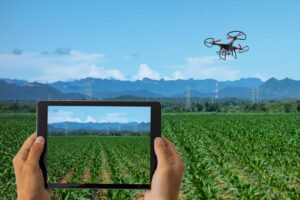
Farmers managing 150–600 acres need precise insights to optimize yields and reduce inputs. Agricultural Drone Mapping Services deliver high-resolution aerial data that reveals crop health, soil variability, and irrigation efficiency. UAVs like the DJI Phantom 5 RTK capture imagery at 2–5 cm GSD, enabling actionable decisions without labor-intensive field surveys.
What Is Agricultural Drone Mapping Services
Agricultural drone mapping uses autonomous UAVs to collect aerial imagery across fields. Multispectral, RGB, and LiDAR sensors capture crop and terrain data. Software converts this into orthomosaic maps, NDVI indices, and elevation models. For example, an RTK-enabled Phantom 5 can survey 250 acres in under 1.5 hours, producing maps accurate to ±3 cm.
Why Farms Are Adopting Drone Technology
| Metric | Traditional Survey | Drone Mapping | Measured Gain |
|---|---|---|---|
| Field Coverage | 50 acres/day | 200–250 acres/hour | +300% efficiency |
| Data Resolution | 10–30 m | 2–5 cm GSD | Precision ↑ |
| Labor Hours | 5–6 operators | 1 operator | -83% manpower |
| Decision Speed | Weekly | Daily | Crop response ↑ |
Farmers in Kansas reported $900 savings per 200-acre wheat field by identifying nitrogen-deficient zones with NDVI maps before applying fertilizers. Drones reduce field compaction and allow multiple surveys per week.
How Agricultural Drone Mapping Services Works Step by Step
Step 1: Pre-Flight Assessment
Measure wind speeds and light conditions with on-site sensors. If wind >12 mph or cloud cover >70%, then postpone the mission. Define field boundaries with RTK base stations to ensure centimeter-level positioning.
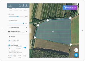
Step 2: Flight Planning
Upload shapefiles and select sensor type (RGB, multispectral, LiDAR). If NDVI analysis is required, configure multispectral bands (NIR, RedEdge). Set flight altitude to achieve target GSD using formula:GSD=Focal Length×Image WidthSensor Width×Flight Height
For a 6.2 mm focal length camera on a 4000 px sensor at 120 m height, GSD ≈ 3.1 cm/pixel.
Step 3: Drone Calibration
Check lithium-silicon battery levels (>90%). Calibrate IMU, compass, and gimbal. Confirm camera settings: shutter speed 1/2000 sec, ISO 100, overlap 80% front/70% side.
Step 4: Data Acquisition
Launch Phantom 5 RTK or similar UAV. Fly autonomous grid pattern over field. Monitor telemetry for flight path deviations. If GPS signal drops <5 m, switch to RTK hold mode to maintain accuracy.
Step 5: Data Processing
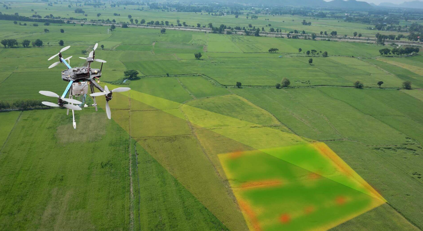
Upload imagery to mapping software. Generate orthomosaics, NDVI, and DSM outputs. Compare vegetation indices across zones. Flag areas below NDVI 0.45 for potential intervention.
Step 6: Post-Flight Recommendations
Export geo-referenced maps to farm management systems. Provide actionable insights: nutrient adjustments, irrigation prioritization, or pest treatment targeting. Document flight logs for compliance and future optimization.
Equipment Used for This Service
| Drone Model | Sensor Type | Flight Time | Coverage | Key Feature |
|---|---|---|---|---|
| DJI Phantom 5 RTK | RGB, Multispectral | 30 min | 200 acres | RTK + GCP support |
| DJI Mavic 3M | Multispectral | 45 min | 150 acres | Foldable, lightweight |
| XAG P40 | LiDAR optional | 25 min | 120 acres | Rapid terrain mapping |
| DJI Matrice 350 RTK | RGB + LiDAR | 40 min | 250 acres | Multi-sensor integration |
Field micro-data includes 2–5 cm GSD resolution, wind speed tolerance <12 mph, and battery-backed RTK base for sub-meter positional accuracy.
Real Farm Use Case
Location: Central Iowa, 300-acre corn field
Drone: Phantom 5 RTK
Flight Conditions: Wind 8 mph, clear skies
Mapping Mission: RGB + NDVI imagery for nitrogen monitoring
Results:
- Total area mapped: 300 acres in 90 minutes
- NDVI maps identified 25% of field with nitrogen stress
- Fertilizer application adjusted by 15% across stressed zones
- Operator: 1 full-time technician
- Data accuracy: ±3 cm GSD, verified with 5 ground control points
Farmers reported improved crop uniformity and estimated $1,000 savings on fertilizer for this single survey.
Pros and Cons of Agricultural Drone Mapping Services
| Pros | Cons |
|---|---|
| High-resolution data (2–5 cm) | High initial investment ($10k–$25k UAV + sensors) |
| Rapid coverage | Requires Part 107 certification |
| Identifies stress zones early | Weather-dependent (wind, clouds) |
| Integrates with farm software | Data processing requires training |
| Reduces manual scouting | Battery limitations for large farms |
Common Challenges and Solutions
| Challenge | Solution | Fact/Data |
|---|---|---|
| GPS signal loss | Use RTK base station or PPK workflow | Phantom 5 RTK: <5 cm drift with RTK |
| Data overload | Pre-plan survey zones; batch process images | 300 acres generate ~12,000 images |
| Cloud cover affecting multispectral | Schedule flights during <50% cloud | NDVI error <5% with ideal light |
Future of Drone Farming Technology
AI-powered real-time crop stress detection will enable immediate precision interventions. Swarm UAV operations can map 500+ acres simultaneously. Lithium-silicon battery improvements promise 50% longer flight times. RTK + GNSS integration will further reduce positional error below 2 cm.
Finding Reliable Drone Service Providers
Choose operators with FAA Part 107 certification, verified NDVI mapping experience, and insurance coverage. Ensure providers maintain documented flight logs and adhere to EPA chemical application limits if integrating spraying with mapping. Local US-based directories help locate compliant service providers near your farm.
FAQ
1. How much does drone mapping cost per acre?
Pricing ranges from $8–$18/acre depending on field size, sensor type, and data processing complexity. Larger farms often realize 20–30% efficiency gains over manual surveys.
2. How accurate are the maps?
RTK-enabled UAVs achieve ±3 cm GSD. Ground control points further improve georeferencing to sub-centimeter levels.
3. Can drones map multiple fields in one day?
Yes, with multi-battery setups and autonomous flight planning, operators can cover 200–400 acres per UAV in a single day.
4. Are these services weather-dependent?
Wind speeds >12 mph or dense cloud cover reduce data quality. Flights are scheduled when conditions allow optimal sensor performance.
5. How do I find a reliable provider?
Look for FAA Part 107 certification, documented NDVI mapping experience, and positive field performance reports. Verify provider compliance with state regulations.