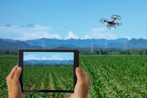
Finding a reliable agricultural drone service provider is harder than it looks.
Not because there aren’t enough options — there are hundreds of operators across the US now. The problem is that most farmers hire someone based on a Google search or a word-of-mouth recommendation without checking the one thing that actually determines whether you get your money’s worth: whether the provider’s equipment, certification, and experience actually match the service they’re selling you.
We’ve gone through the major players, checked their FAA compliance status, compared their pricing structures, and matched each one to the crop types and farm sizes they genuinely serve well. If you want the full background on what each service type actually involves before diving into this comparison, our complete guide to agricultural drone services for US farmers breaks down everything from NDVI mapping to variable-rate spraying in plain language.
Here’s who’s doing it well in 2026, and more importantly — which type of provider actually fits your farm.
What Separates a Good Provider from a Bad One
Before getting into names, it’s worth understanding what actually separates a competent agricultural drone operator from someone who just owns a DJI and prints business cards.
Three things matter more than anything else.
The first is FAA Part 107 certification. This isn’t optional — it’s the legal baseline for any commercial drone operation in the US. A provider operating without it puts you at risk too, since the landowner can be held liable if something goes wrong. You can verify any operator’s certificate number at faa.gov. If they won’t give it to you, walk away. Our FAA regulations guide for 2026 covers exactly what to check and what the rules mean for your operation.
The second is equipment match. A company that does great NDVI mapping for vineyards isn’t necessarily the right choice for 800-acre corn spraying. The DJI Agras T50 is what you want for high-volume spray coverage. The DJI Phantom 5 RTK is the right tool for precision mapping and crop health analysis. These are different machines with different capabilities. A good provider will have the right drone for your specific service — and they’ll tell you exactly which model they’re deploying before the job starts.
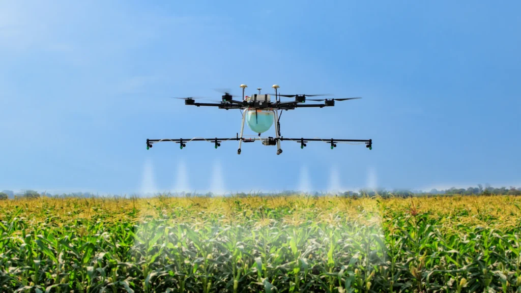
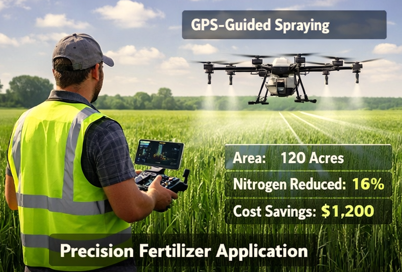
The third is data quality. For spraying, this means variable-rate application capability, not just blanket coverage at altitude. For mapping, it means orthomosaic outputs, NDVI heat maps, and actionable recommendations — not just a folder of raw photos. Anyone can fly a drone. Delivering usable farm intelligence is a different skill set entirely.
| Factor | What to Verify | Red Flag |
|---|---|---|
| FAA Certification | Part 107 certificate number | Refuses to provide it |
| Equipment | Drone model + sensor type for your service | Vague answers about “equipment varies” |
| Data Deliverables | Sample reports from prior clients | No samples available |
| Insurance | $1M+ liability, including chemical drift | No coverage or won’t confirm |
| Pricing | Clear per-acre rate with inclusions | “Depends” with no baseline |
| Cancellation Policy | Weather + rescheduling terms | No written policy |
The Types of Agricultural Drone Service Providers in the US
The market has split into three clear tiers in 2026. Understanding which tier fits your farm size and service needs will help you cut through the noise immediately.
Tier 1: National full-service operators — Large companies operating across multiple states with standardized equipment fleets, certified pilots, and full-service data packages. Best for farms above 500 acres needing repeatable, documented results. Usually the most expensive per acre but the most consistent.
Tier 2: Regional specialists — Mid-size operators covering a few states or a specific agricultural region. Often specialise in one or two crop types (corn and soybeans in the Midwest, vineyards in California, cotton in the Southeast). Strong on local knowledge, competitive pricing, and responsiveness. Best for 200–500 acre operations.
Tier 3: Local FAA-certified operators — Individual or small-team operators serving a county or multi-county area. Most competitive on price. Quality varies significantly — some are exceptional, others are barely above hobby level. Require the most due diligence from you as the farmer.
Best Agricultural Drone Service Providers in the USA (2026)
1. Rantizo — Best for Large-Scale Corn and Soybean Spraying
Headquarters: Iowa City, Iowa
Service Area: Midwest, expanding Southeast
Primary Service: Precision crop spraying, NDVI-guided variable rate application
FAA Status: Part 107 certified, BVLOS waiver pending in multiple states
Equipment: DJI Agras T50, proprietary job management platform
Typical Pricing: $12–$18 per acre for spraying
Rantizo has built one of the most disciplined operational models in the US agricultural drone space. They run standardized equipment fleets — which means the DJI Agras T50 you were quoted is the actual machine that shows up — and their pilots follow documented SOPs for every mission. For Midwest grain farmers dealing with soybean aphids, corn fungicide applications, or variable-rate fertilizer passes, they’re consistently among the top performers in coverage speed and application accuracy.
What sets them apart is their data integration. They connect spray mission data directly into farm management software, so you’re not just getting acres covered — you’re getting a documented record of application rates, coverage maps, and field conditions for every pass. That traceability matters increasingly for crop insurance documentation.
The downside is geographic coverage. If you’re farming in the Southeast or West, they may not be your best option yet. Their Midwest density is strong; outside that, quality can vary by subcontractor.
Best fit: Corn, soybean, wheat farms in the Midwest above 300 acres.
2. DroneUp — Best for Full-Service Mapping + Spraying Combinations
Headquarters: Virginia Beach, Virginia
Service Area: Nationwide
Primary Service: Crop mapping, NDVI analysis, aerial imaging, spraying
FAA Status: Part 107 certified across all operators
Equipment: Multi-platform fleet (DJI Phantom 5 RTK for mapping, DJI Agras T50 for spraying)
Typical Pricing: $8–$12 per acre mapping; $14–$22 per acre spraying; combined packages available
DroneUp is one of the few companies in the US that has genuinely built a national footprint without sacrificing data quality. Their operator network is large, but they run consistent certification checks and equipment audits on every pilot in their system — which matters more than the network size itself.
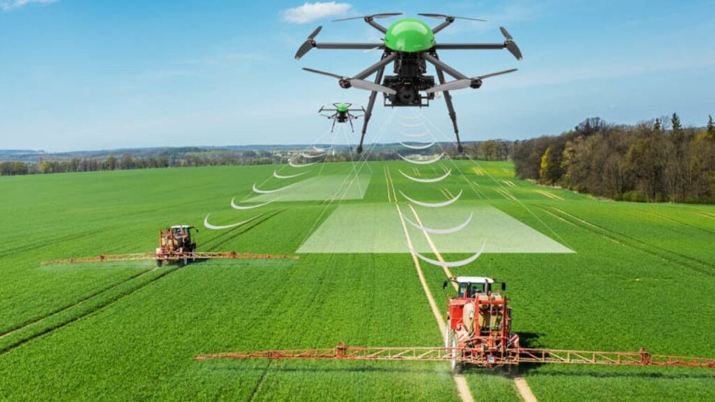
Their strength is in combined mapping and spraying jobs. If you want an NDVI map run first to identify stress zones and then a variable-rate spray pass to address them in the same week, DroneUp has the operational capacity to coordinate that as a single engagement. That kind of integration is where farms see the 12–15% chemical reduction results that show up in the field trials.
Their reporting format is particularly strong for farmers interfacing with ag advisors or crop consultants — the NDVI outputs are clearly annotated and include a plain-language recommendation layer that doesn’t require GIS expertise to interpret. For more on what high-quality NDVI outputs should look like and how to read them, our crop health monitoring guide walks through the key metrics.
Best fit: Farms of any size looking for a single provider to handle both mapping and spraying nationally.
3. FlyGuys — Best for One-Off Aerial Imaging and Farm Surveys
Headquarters: Los Angeles, California
Service Area: Nationwide
Primary Service: Aerial farm imaging, orthomosaic mapping, RGB surveys
FAA Status: Part 107 certified
Equipment: DJI Matrice 300 RTK, DJI Phantom 5 RTK
Typical Pricing: $6–$10 per acre imaging; project rates available
FlyGuys operates a vetted marketplace model — you submit your job, they match you with a certified local operator from their network who has the right equipment for the service. The vetting process is more rigorous than most marketplace competitors, and the output quality is consistent.
They’re not built for repeat spraying operations. But for farmers who need a one-time aerial imaging survey — before planting, mid-season for crop insurance documentation, or post-harvest for field condition assessment — FlyGuys delivers fast turnaround and competitive pricing. Most jobs are matched within 48 hours and completed within a week.
Their orthomosaic quality is excellent at the price point, and the raw files are delivered in formats compatible with Pix4D, DroneDeploy, and most farm management software. For a full breakdown of what aerial imaging services deliver and how to use the outputs practically, see our aerial farm imaging guide.
Best fit: Farms needing one-time or seasonal imaging, insurance documentation, or farm condition surveys.
4. Measure — Best for Enterprise Farms and Multi-Location Operations
Headquarters: Washington, D.C.
Service Area: Nationwide
Primary Service: Precision mapping, infrastructure inspection, crop monitoring programs
FAA Status: Part 107 certified; enterprise compliance programs
Equipment: Multi-platform enterprise fleet
Typical Pricing: Custom enterprise pricing; typically $10–$25 per acre depending on service complexity
Measure is not the right fit for a single-farm operator looking for a quick quote. They’re built for large agricultural enterprises — think multi-location grain operations, large cotton producers, or vertically integrated ag businesses that need standardized data collection protocols across dozens of fields.
Their value is in repeatability and documentation. Every mission follows the same protocol, every output is in the same format, and the data is structured for integration into enterprise farm management systems. If you’re managing 3,000 acres across five counties and need your drone service data to feed directly into a centralized analytics platform, Measure is one of very few providers actually built for that.
For an understanding of how these large-scale operations connect drone data to broader precision agriculture technology stacks, our precision agriculture technology guide covers the full integration picture.
Best fit: Large enterprise farms, multi-location agricultural businesses, and operations requiring documented data continuity.
5. Local FAA-Certified Operators — Best Value If You Vet Properly
This category deserves its own section because it’s where most farmers end up — and where the widest quality gap exists.
A skilled local operator with a DJI Agras T50, a current Part 107 certificate, and two seasons of agricultural experience can deliver results on par with a national company for 20–30% less per acre. That’s a real saving on 400+ acre operations. The problem is finding them, and verifying them properly before you commit.
The USDA’s Ag Census data shows that the majority of agricultural drone services in the US are performed by operators with fewer than five employees. Most are one or two-person operations. Many are excellent. Some are not. The difference isn’t always obvious from a website or a conversation.
Here’s how to vet a local operator properly before signing anything:
First, ask for their FAA Part 107 certificate number and verify it directly at faa.gov. This takes two minutes and immediately separates legitimate operators from people who shouldn’t be flying commercially.
Second, ask what drone they use for your specific service type. For spraying, you want an RTK-enabled sprayer with a minimum 10L tank and variable-rate nozzle capability. For NDVI mapping, you want a multispectral sensor — an RGB camera alone won’t give you the plant stress data you’re paying for.
Third, ask for sample reports from a comparable farm. Not a brochure — actual output files from a job similar to yours. The quality of those outputs will tell you more than any conversation.
Fourth, confirm their liability insurance. You need $1M minimum for commercial drone operations, and for spraying specifically, you need drift coverage. Chemical drift onto neighboring fields is a real risk, and an uninsured operator leaves you exposed.
Our cost and pricing guide includes regional pricing benchmarks that will help you evaluate whether a local operator’s quote is in line with the market.
Provider Comparison at a Glance
| Provider | Best For | Service Area | Price Range | Standout Feature |
|---|---|---|---|---|
| Rantizo | Corn/soybean spraying | Midwest | $12–$18/acre | Standardized equipment + traceability |
| DroneUp | Mapping + spraying combined | Nationwide | $8–$22/acre | Full-service integration |
| FlyGuys | One-time imaging/surveys | Nationwide | $6–$10/acre | Fast matching, vetted network |
| Measure | Enterprise multi-location | Nationwide | Custom | Repeatable data protocols |
| Local operators | Best value, all services | Varies | $8–$18/acre | Price + local knowledge |
Which Provider Is Right for Your Farm Size?
Farm size is the single biggest variable in choosing between providers. Here’s a practical framework based on acreage.
Under 100 acres: A local FAA-certified operator is almost always the right call. National companies either won’t take the job or will price it at rates that don’t make economic sense at this scale. Find a vetted local operator, use the checklist above, and you’ll get solid results for $8–$12 per acre.
100–300 acres: This is where regional specialists start to make sense. DroneUp’s marketplace model works well at this scale, and if you’re in the Midwest, Rantizo is worth a direct quote for spraying work. A good local operator with the right equipment is still competitive — use the sample report test to separate the serious ones.
300–800 acres: You have real leverage at this scale, and combined service packages start making financial sense. The ROI on a mapping-then-spray sequence — NDVI first, variable-rate application second — typically justifies the additional mapping cost through chemical savings alone. DroneUp and Rantizo both serve this range well. Budget $15–$25 per acre for a combined job and model the ROI against your current chemical spend.
800+ acres: At this scale, the documentation and repeatability of a company like Measure starts making operational sense beyond just the service delivery. You’re managing enough land that data continuity — the same format, the same protocols, season over season — has real value for yield analysis and input planning.
For a worked ROI example at different farm sizes, our pricing per acre guide runs through the numbers for a 300-acre and a 1,000-acre operation side by side.
Don’t Overlook These Specialist Use Cases
Most of the coverage in this space focuses on crop spraying and NDVI mapping because those are the highest-volume services. But two other service types have seen significant adoption in 2026 that are worth knowing about when evaluating providers.
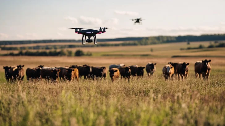
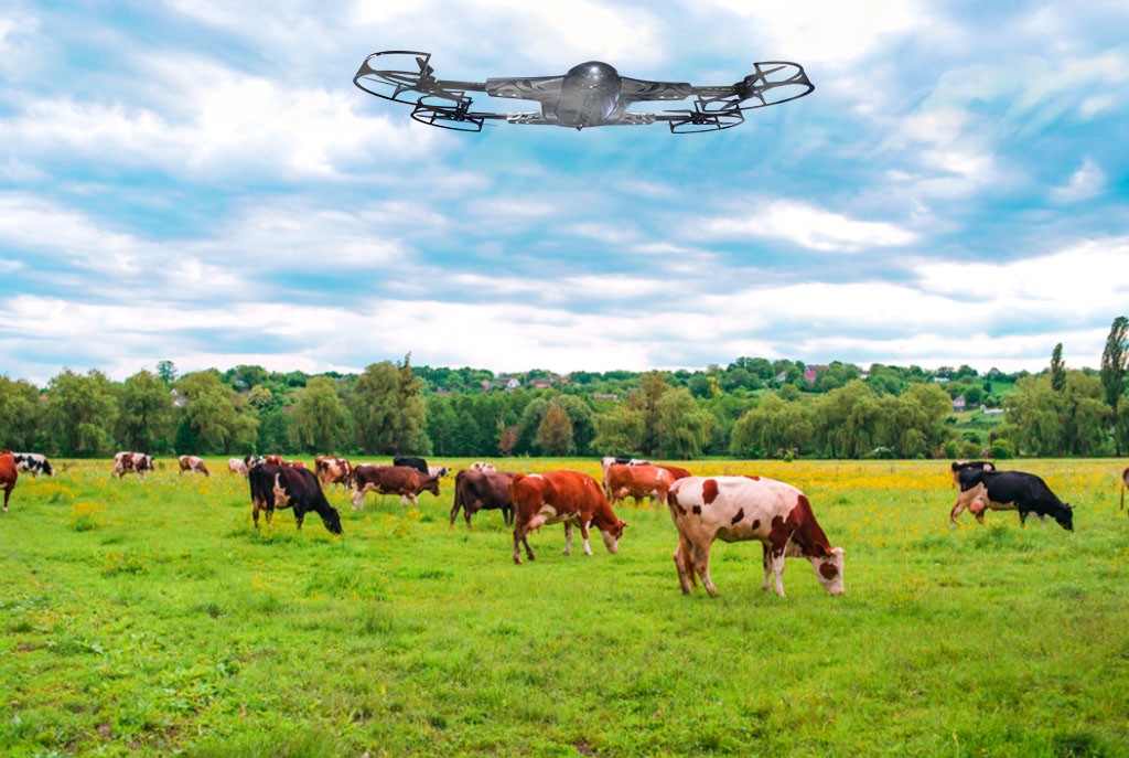
Livestock monitoring is growing fast in the ranching states — Texas, Montana, Wyoming, and the Dakotas especially. Thermal drone services allow ranchers to track herd location, identify animals in distress, and count livestock across 1,000+ acre pastures in under two hours. Work that previously required a full day on horseback. Not every agricultural drone company offers thermal monitoring — it requires different equipment and a different operational skill set. Our livestock monitoring drone guide covers which providers serve this niche and what to look for.
Drone mapping for drainage and irrigation planning is increasingly being used as a pre-investment tool before major field infrastructure changes. A detailed elevation map and drainage analysis from a drone survey costs $600–$1,200 for a 200-acre field — a fraction of what a poor drainage design costs to fix after the fact. Our drone mapping guide explains the process and outputs in detail.
Before You Hire Anyone: A Quick Verification Checklist
Print this out or screenshot it. Run every provider through it before you sign anything.
- FAA Part 107 certificate verified at faa.gov — not just promised
- Equipment confirmed in writing — drone model and sensor type for your specific job
- Sample reports reviewed — actual outputs from a comparable prior job
- Liability insurance confirmed — $1M+ including chemical drift for spraying
- Pricing in writing — per-acre rate with clearly listed inclusions and exclusions
- Weather cancellation policy — written terms for rescheduling and notification
- Data ownership confirmed — your farm data doesn’t get shared or reused
- Deliverable format confirmed — compatible with your farm management software
If a provider can’t or won’t confirm all eight of these in writing before you hire them, that’s your answer.
Frequently Asked Questions
-
How much should I expect to pay for agricultural drone services in 2026?
Crop spraying typically runs $10–$22 per acre depending on the provider tier and region. NDVI mapping runs $5–$12 per acre. Combined packages (mapping then variable-rate spray) run $18–$35 per acre. These are market benchmarks — local operators in lower-cost regions can be 15–25% below these figures. Full regional pricing data is in our cost per acre guide.
-
Do I need to be present during the drone operation?
Not required, but recommended for your first job with any new provider. You want to verify the equipment matches what was quoted, watch the pre-flight calibration process, and confirm the field boundaries before the mission starts. After you’ve established trust with a provider, you don’t need to be there for every repeat job.
-
What happens if weather cancels my scheduled job?
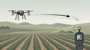
Any legitimate provider will have a written weather cancellation policy. Wind above 15 mph is the standard threshold for most drone operations. The provider should notify you within 24–48 hours of your scheduled date if conditions aren’t favorable and provide a clear rescheduling process. Confirm this policy before booking.
-
Can a drone service provider operate on my farm without an FAA certificate?
No. Any commercial drone operation in the US requires FAA Part 107 certification. Operations without it are illegal and expose both the operator and potentially the landowner to liability. Verify every operator before they fly.
-
What’s the difference between a drone mapping company and a drone spraying company?
These are different services requiring different equipment and different skills. Mapping companies use multispectral or RGB cameras to generate field health data. Spraying companies deploy liquid payloads for pesticide, herbicide, or fertilizer application. Some providers offer both — DroneUp and Rantizo are examples. Many do only one. Make sure the company you hire has the specific equipment and certification for the service you actually need.
-
How do I find local FAA-certified drone operators near my farm?
The FAA’s DroneZone database is a starting point, though it doesn’t filter specifically for agricultural operators. Searching state agricultural extension networks, local farm bureau contacts, and regional agricultural drone associations will often surface operators with actual farming experience rather than general commercial operators who happen to hold a Part 107 certificate.
The Bottom Line
There’s no single best agricultural drone service provider for every farm. The right answer depends on what you’re growing, how many acres you’re managing, which services you actually need, and where you’re located.
What doesn’t change is the verification standard. Whether you hire Rantizo, DroneUp, a local operator in your county, or anyone else — run the eight-point checklist above before anything else. The most common reason farmers are disappointed with drone service results isn’t the technology. It’s mismatched expectations that could have been caught with basic due diligence before the job started.
If you’re still at the stage of evaluating whether drone services make economic sense for your operation at all, our complete agricultural drone services guide includes a worked ROI example for multiple farm sizes and crop types that will give you a concrete number to work with before you contact any provider.
Content accurate as of May 2026. Provider availability, pricing, and service areas are subject to change. Always verify current credentials and pricing directly with providers before engaging.