Introduction
Agricultural drones are unmanned aerial systems used in farming to improve efficiency in crop spraying, field monitoring, and agricultural mapping. These drones help farmers reduce manual labor, optimize resource usage, and make more accurate decisions based on real-time field data.
However, most online explanations incorrectly mix physical drone designs with their functional roles. This creates confusion for beginners and weakens search engine understanding. In reality, agricultural drones should be classified into two clear categories: airframe types and application systems. This separation reflects how drones actually operate in real farming environments.
1. Drone Airframe Types (Physical Structure)
Drone airframe types define the physical design of the drone. This determines how it flies, how stable it is in the air, how far it can travel, and how much load it can carry. Airframes are the foundation of every agricultural drone system.
Multi-Rotor Drones
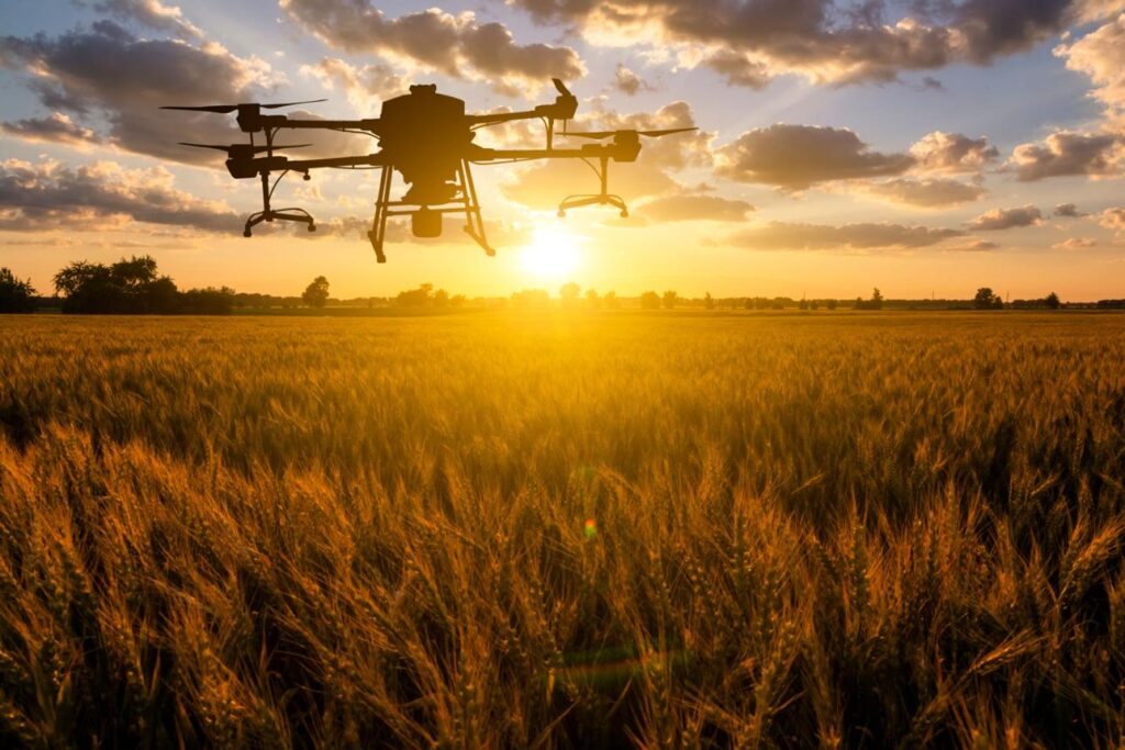
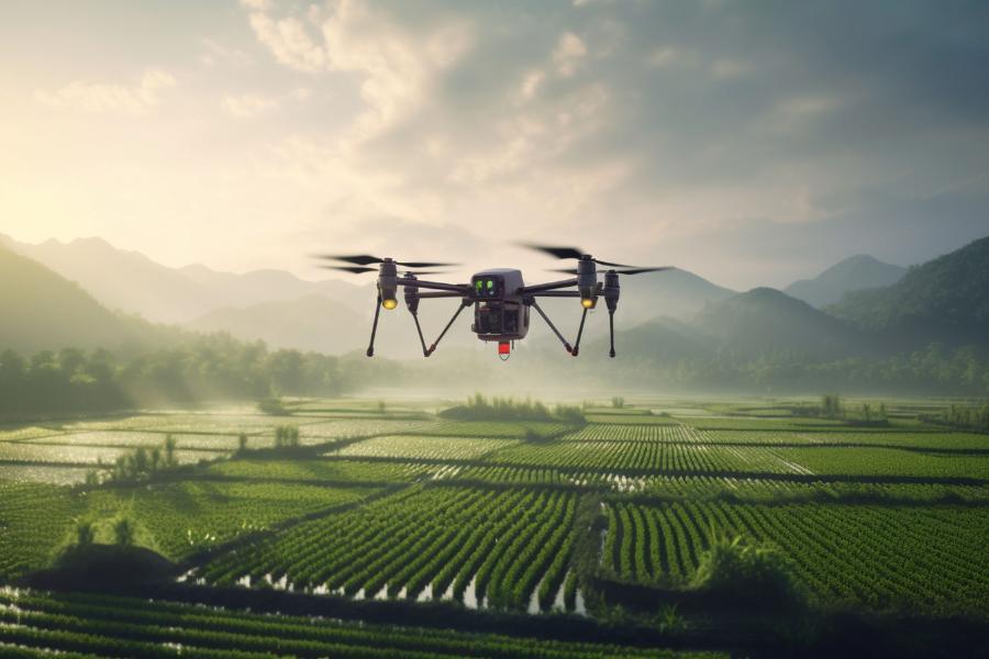
Multi-rotor drones are the most commonly used agricultural drones in modern farming. They use multiple propellers to generate lift, allowing them to take off vertically, hover in place, and move in any direction with high precision.
These drones are especially useful in farming situations where accuracy is more important than long-distance coverage. Because they can hover over a specific crop area, they allow farmers to perform detailed inspections and targeted spraying. This makes them ideal for small and irregular farm fields where precision is required.
However, multi-rotor drones have a limited flight time due to battery constraints. This means they are not suitable for covering very large farms in a single flight, but they remain the most practical option for precision agriculture tasks.
Agricultural Uses:
- Crop spraying
- Field inspection
- Targeted crop monitoring
Limitations:
- Short flight time (10–25 minutes)
- Limited coverage per mission
Fixed-Wing Drones
Fixed-wing drones are designed in an airplane-like structure where lift is generated through forward motion rather than hovering. Once launched, they must keep moving to stay in the air, which makes them highly efficient for covering large areas.
These drones are primarily used in agriculture for large-scale mapping and surveying. They can fly long distances in a single flight, making them extremely useful for monitoring large farms and collecting agricultural data over wide regions.
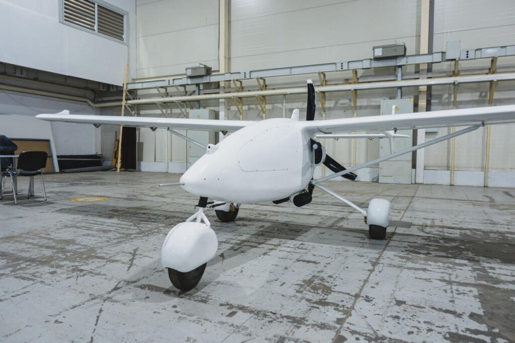
Because they cannot hover, fixed-wing drones are not suitable for spraying or close inspection tasks. They also require proper space for takeoff and landing, which limits their flexibility in smaller fields.
Agricultural Uses:
- Drone land surveying
- Large-scale agricultural mapping
- Crop monitoring across wide areas
Limitations:
- Cannot hover
- Requires launch/landing space
Hybrid VTOL Drones
Hybrid VTOL drones combine vertical takeoff capability with fixed-wing flight efficiency. They can lift off vertically like a helicopter and then transition into forward airplane-style flight during operation.
These drones are used in advanced agricultural operations where both flexibility and long-range capability are required. They are especially useful in large farms where runway space is not available but extended flight range is necessary for mapping or monitoring.
While they offer high performance and flexibility, they are more expensive and require skilled operators. This makes them more common in commercial agriculture rather than small-scale farming.
Agricultural Uses:
- Large farm monitoring
- Long-distance mapping
- Remote agricultural surveying
Limitations:
- High cost
- Requires technical expertise
Airframe Comparison Table
| Drone Type | Description | Strength | Best Use Case | Limitation |
|---|---|---|---|---|
| Multi-Rotor | Hovering drone with multiple propellers | High precision control | Spraying & inspection | Short flight time |
| Fixed-Wing | Airplane-style continuous flight drone | Long-range efficiency | Large farm mapping | Cannot hover |
| VTOL Hybrid | Combines vertical takeoff and fixed-wing flight | Flexibility + range | Commercial agriculture | Expensive |
2. Agricultural Drone Application Systems (Functional Use)
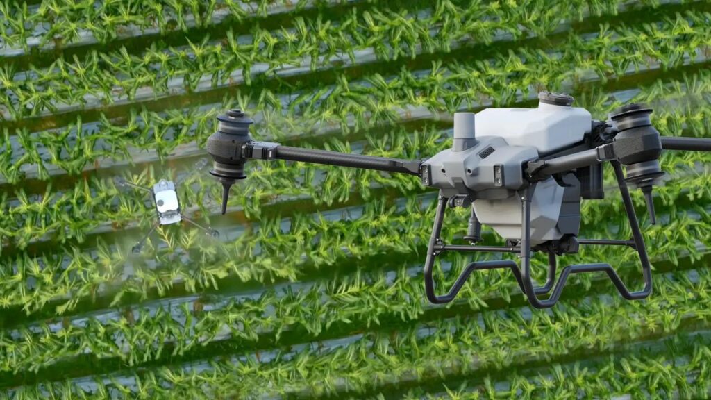
Application systems define what the drone actually does in agriculture. These are not separate drone types but functional roles enabled by different payload systems. A single drone can perform multiple tasks depending on the equipment installed.
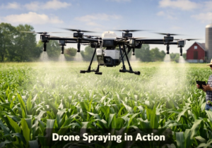
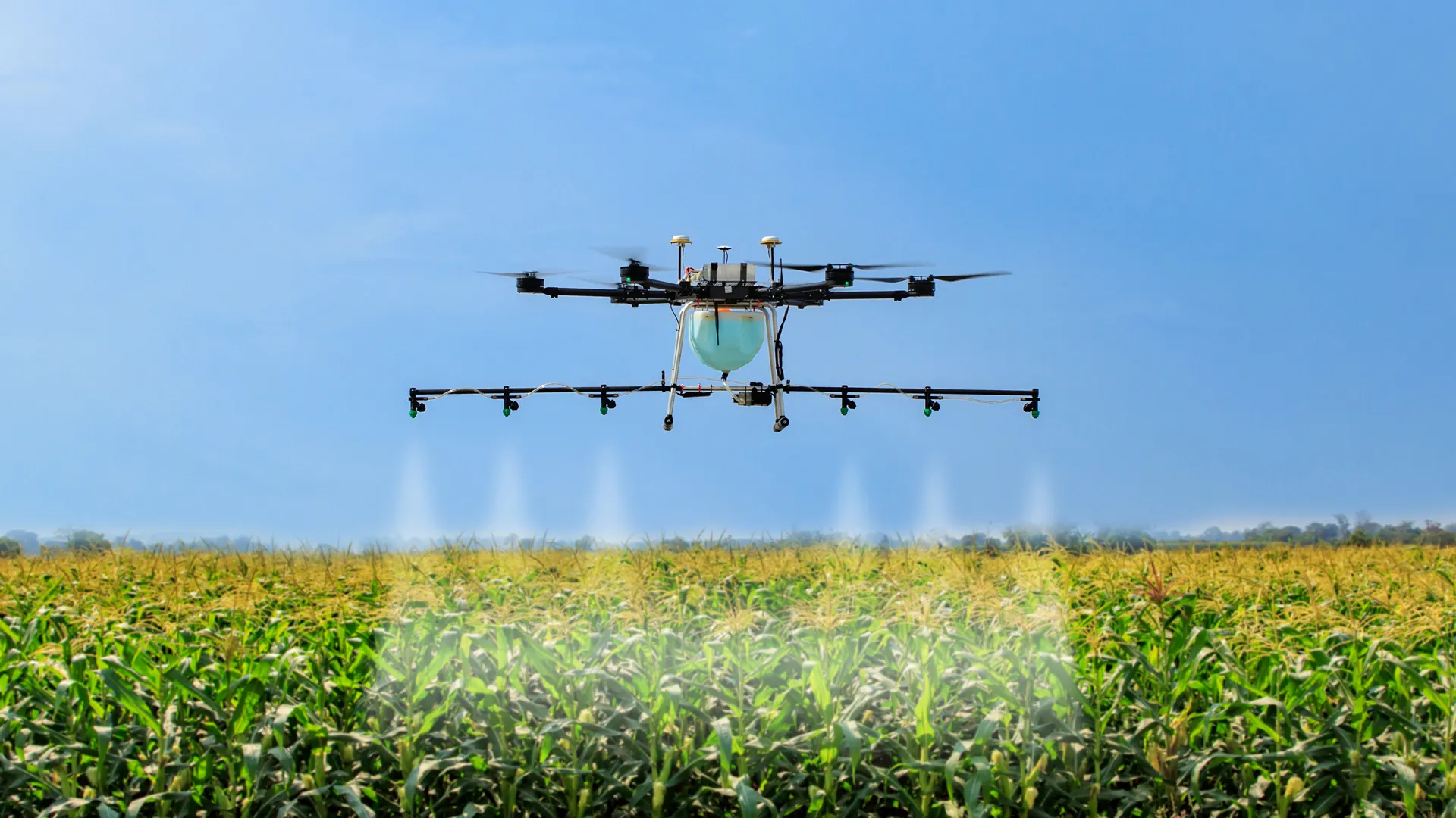
Crop Spraying Systems
Crop spraying systems are agricultural drone setups designed to apply fertilizers, pesticides, and herbicides directly onto crops. These systems are usually mounted on multi-rotor drones because they require stable hovering and precise control during chemical application.
This system is widely used in modern farming because it reduces chemical waste and ensures that only targeted areas of a field are treated. Unlike traditional spraying methods that rely on heavy machinery, drones can operate over uneven terrain without damaging crops or soil.
Although highly efficient, spraying systems are affected by weather conditions such as wind and rain, and they also require frequent battery replacement during large operations.
Agricultural Uses:
- Fertilizer application
- Pesticide spraying
- Weed control
Limitations:
- Weather sensitive
- Battery dependent operations
Multispectral Imaging Systems
Multispectral imaging systems use specialized sensors mounted on drones to capture different wavelengths of light that are invisible to the human eye. These sensors allow farmers to analyze crop conditions in much greater detail than traditional visual inspection.
This technology is used to detect early signs of crop stress, nutrient deficiency, water imbalance, and disease development. The data collected is processed into NDVI maps, which visually represent crop health across the entire field.
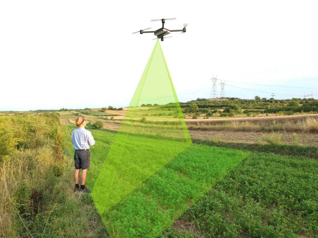
By using this system, farmers can make data-driven decisions and apply fertilizers or treatments only where needed. This improves efficiency and reduces farming costs while increasing yield potential.
Agricultural Uses:
- Crop health monitoring
- Disease detection
- Nutrient analysis
Limitations:
- Requires data interpretation
- Higher operational cost
Drone Mapping and Survey Systems
Drone mapping systems are used to create detailed digital representations of farmland by capturing high-resolution aerial images and converting them into structured maps. These maps provide valuable insights into land conditions and farm layout.
This system is commonly used for land surveying, irrigation planning, boundary mapping, and agricultural development planning. It is especially useful for large farms where manual surveying would take too much time and effort.
The main limitation is that the collected data requires processing through specialized software, which can generate large datasets that need proper storage and analysis tools.
Agricultural Uses:
- Land surveying
- Field boundary mapping
- Irrigation planning
Limitations:
- Requires processing software
- Large data handling requirements
Application Systems Comparison Table
| System Type | Explanation | Output | Main Use Case | Limitation |
|---|---|---|---|---|
| Crop Spraying | Chemical application system | Targeted spray distribution | Crop protection | Weather dependency |
| Multispectral | Sensor-based crop analysis | NDVI health maps | Precision farming | Data complexity |
| Mapping System | Aerial data conversion system | Digital farm maps | Farm planning | Software required |
3. Final Classification Summary
Agricultural drones are best understood through a two-layer classification system.
Airframe types define how the drone physically operates in the air, including multi-rotor, fixed-wing, and hybrid VTOL systems. These determine flight behavior, stability, and range.
Application systems define what the drone does in agriculture, including spraying, multispectral analysis, and mapping. These depend on the payload rather than drone design.
This classification reflects real-world agricultural drone usage and aligns with how modern AI systems interpret technical agricultural information.
4. FAQ
What are the main types of agricultural drones?
Agricultural drones are classified into airframe types such as multi-rotor, fixed-wing, and hybrid VTOL, and application systems such as spraying, mapping, and multispectral imaging.
What is the difference between drone types and drone applications?
Drone types refer to the physical design of the drone, while applications refer to the farming tasks performed using different drone payloads.
Which agricultural drone is best for spraying crops?
Multi-rotor drones are best for spraying because they can hover and apply chemicals with high precision.
Can agricultural drones perform multiple functions?
Yes, a single drone can switch between spraying, mapping, and crop monitoring depending on its installed payload.
What is NDVI in agriculture?
NDVI is a vegetation index used in multispectral imaging to detect crop health, stress levels, and nutrient deficiencies.