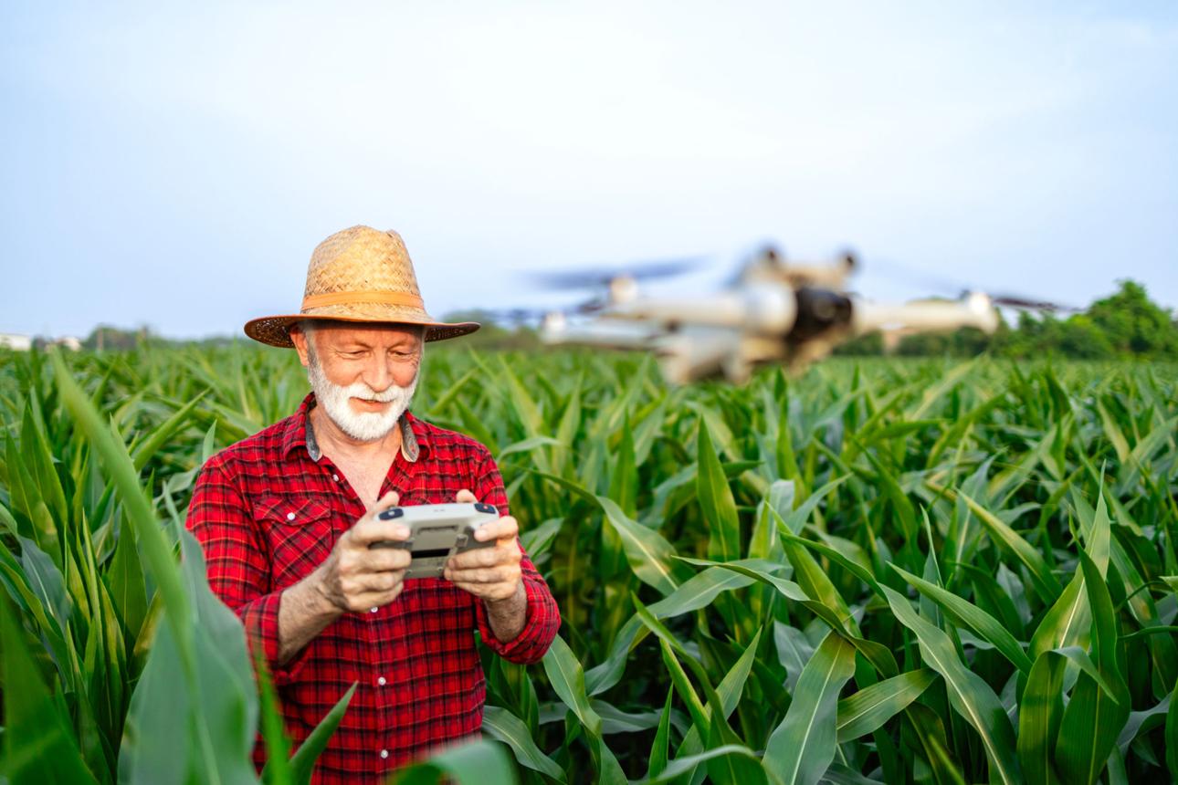
As we know farming is evolving rapidly as farmers adopt technology to increase efficiency and reduce costs. Agricultural drones are becoming essential tools for crop monitoring, precision spraying, and mapping large fields. By using UAVs, farmers can detect crop stress early, monitor irrigation patterns, and optimize chemical use, saving time and resources across hundreds of acres.
How Agricultural Drone Technology Works
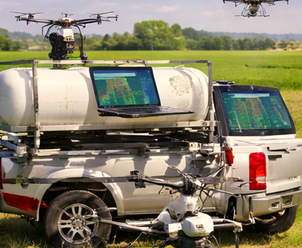
Agricultural drones operate using a combination of GPS flight automation, advanced sensors, and aerial mapping software. First, farmers define field boundaries using GPS coordinates. The drone then follows a pre-programmed route, capturing high-resolution images and data.
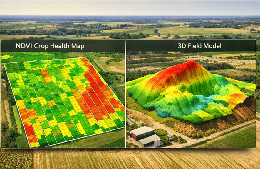
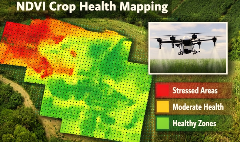
Sensors like multispectral cameras measure plant health using indices such as NDVI, which helps detect early nutrient deficiencies. Some drones include precision spraying systems that adjust chemical application in real time based on the data collected. Flight paths are automated, but operators can intervene if wind speeds exceed 15 mph to maintain safety and accuracy.
Collected data is processed using specialized software to produce maps that show crop stress, water distribution, and pest or disease hotspots. This allows farmers to make informed decisions for fertilization, irrigation, or pest management.
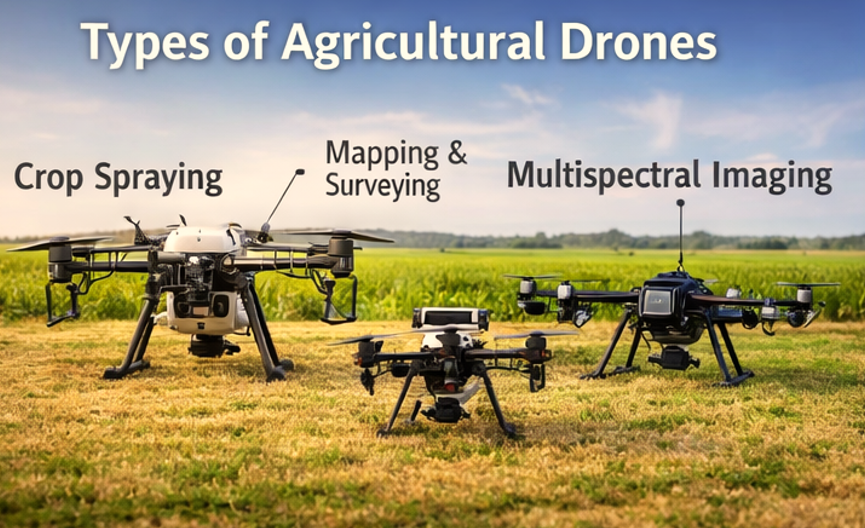
Types of Agricultural Drones
| Drone Type | Primary Use | Key Features |
|---|---|---|
| Crop Spraying Drones | Chemical application | High payload, variable rate spraying, automated spraying patterns |
| Drone Mapping Services | Field analysis | Multispectral/RGB imaging, automated flight planning, NDVI maps |
| Multispectral Imaging Drones | Health monitoring | Detect plant stress, early disease detection, supports precision agriculture |
Crop spraying drones are ideal for applying fertilizers or pesticides efficiently. Drone mapping services help visualize farm conditions. Multispectral drones provide detailed plant health data for proactive management.
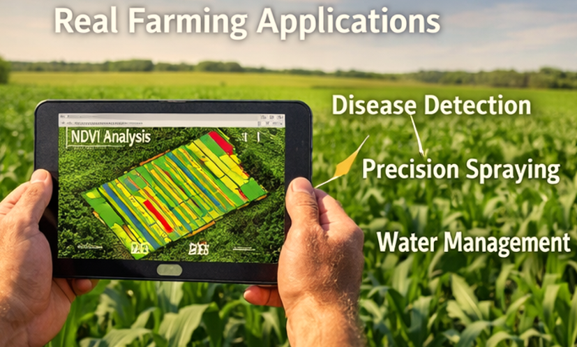
Real Farming Applications
- Early Disease Detection
On a 300-acre corn farm in Iowa, UAV imaging detected fungal stress in 12% of plants before symptoms were visible. Farmers applied targeted fungicide, preventing a potential 5-bushel per acre loss. - Reducing Chemical Usage
Using variable rate spraying, a 400-acre wheat farm reduced herbicide use by 18%, saving approximately $1,200 per season. - Irrigation Optimization
Thermal imaging drones identified water-stressed zones across a 500-acre soybean field. Targeted irrigation improved water efficiency by 10% and increased yield by 3 bushels per acre.
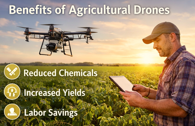
Benefits for Farmers
- Labor Savings: UAVs can survey hundreds of acres in hours, replacing days of manual scouting.
- Early Problem Detection: Multispectral imaging detects stress before visible symptoms appear.
- Precision Input Application: Variable-rate spraying reduces chemical overlap, lowering costs.
- Data-Driven Decisions: Farmers can prioritize interventions, optimizing resources and improving yields.
These advantages make Agricultural Drone Services a practical investment for modern farms.
Limitations and Challenges
- Weather Dependency: High winds or rain can delay flights.
- Battery Life: Most drones fly 30–50 minutes per battery, limiting coverage per flight.
- Training Requirements: Operators need Part 107 certification and experience with drone software.
- Data Processing: Large datasets require compatible software and cloud storage.
Solutions include splitting large fields into multiple zones, using extra batteries, and training operators on data processing workflows.
Costs and Efficiency
Drone operations can be cost-effective compared to traditional methods.
| Farm Activity | Traditional Cost | Drone Cost | Efficiency Gain |
|---|---|---|---|
| Scouting 100 acres | $20/hour | $8/acre | 60% labor reduction |
| Chemical application | $30/acre | $25/acre | 15% chemical savings |
| Irrigation monitoring | Manual | Automated via UAV | 10% water reduction |
Farmers see a return on investment within 1–2 growing seasons, particularly on medium to large-scale farms where labor savings and precision management are significant.
Future of Agricultural Drone Technology
By 2026, drones will integrate AI-powered crop analysis, automated fleets, and farm management platforms. BVLOS flights and extended battery life will expand coverage, while advanced sensors will detect diseases, nutrient stress, and irrigation inefficiencies earlier than ever. Adoption is growing as farms seek data-driven solutions to meet rising production demands and environmental standards.
How Farmers Can Find Reliable Drone Services
- Verify Part 107 certification and BVLOS waivers if required.
- Confirm experience with crop types and field sizes similar to your farm.
- Request sample NDVI, RGB, or thermal maps.
- Ensure service providers support software for variable-rate input application.
For trusted options, explore Agricultural Drone Services, Drone Mapping Services, and Crop Spraying Drone Services in the US-based directory.
FAQ Section
1. How accurate are agricultural drones?
Most drones using RTK or PPK systems achieve ±2 cm positional accuracy. This is sufficient for field-scale NDVI mapping and precision spraying.
2. Are drone spraying services expensive?
Costs vary between $6–$10 per acre depending on payload and sensors. Savings from reduced chemicals and labor often offset the investment.
3. Can drones detect crop diseases?
Yes. Multispectral and thermal imaging can identify stress or disease 1–2 weeks before visible signs, allowing early intervention.
4. Do farmers need licenses to use drones?
Yes. Operators require FAA Part 107 certification. BVLOS operations need specific waivers.
5. How large of a farm can a drone cover?
Drone coverage depends on battery life, payload, and flight altitude. Most commercial drones can survey 400–600 acres per day with multiple flights.
Leave a Reply