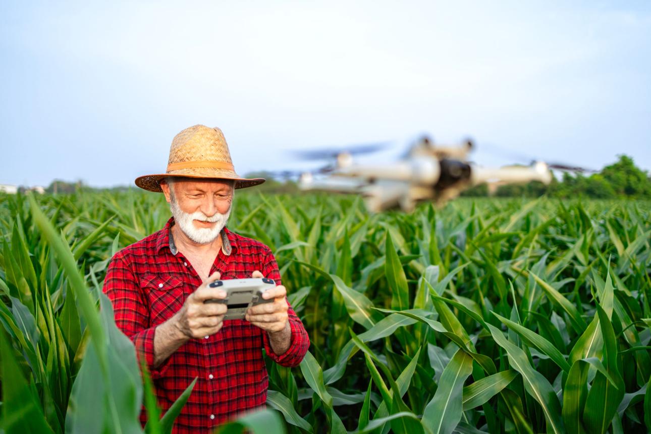
In the modern era agriculture is evolving rapidly, driven by technological innovations that help farmers grow more efficiently and sustainably. Among these innovations, Agricultural Drone Technology is becoming a cornerstone for precision farming. One of the most transformative applications is drone mapping, which allows farmers to create detailed, high-resolution maps of their fields. These maps help optimize crop management, monitor plant health, and make data-driven decisions that can improve yield and reduce costs.
Farmers adopting drone mapping services can identify issues that are invisible to the naked eye, plan interventions more precisely, and save both time and resources. For example, a farmer can quickly detect areas of uneven crop growth and adjust irrigation or fertilizer application accordingly.
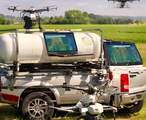
How Agricultural Drone Technology Works
Drone Mapping Services rely on several advanced technologies to capture accurate, actionable data from farm fields.
- GPS Flight Automation
Drones use GPS systems to fly pre-programmed routes across a farm. These automated flights ensure full coverage of fields and consistent data collection, reducing human error. - Crop Monitoring Sensors
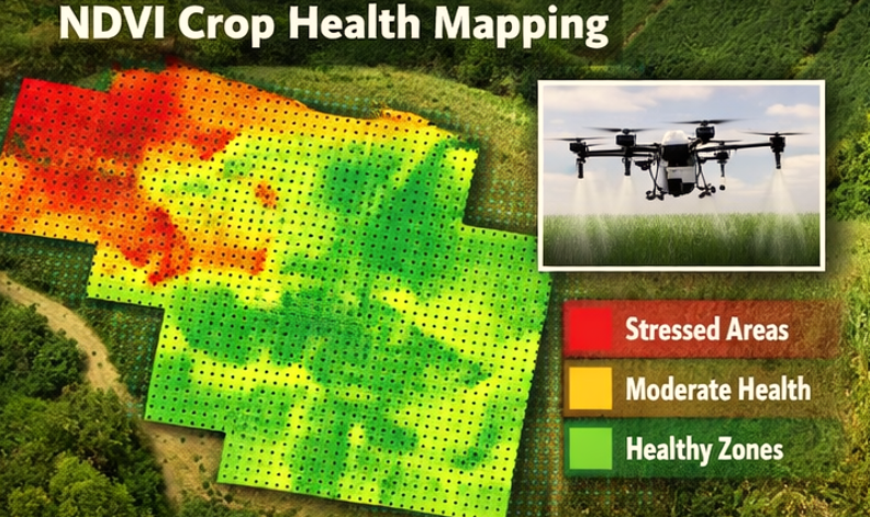
Many drones carry multispectral or thermal cameras that detect crop stress, soil moisture levels, and plant health. These sensors capture data that can reveal disease, pest infestations, or water deficiency early. - Aerial Imaging and Data Processing
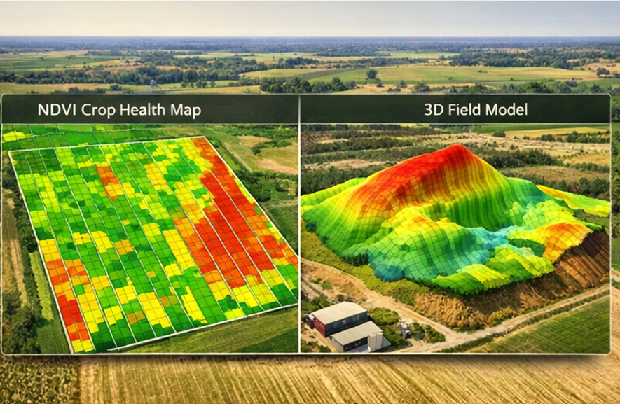
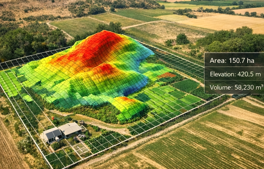
As drones fly over fields, they capture thousands of images. Advanced software stitches these images into high-resolution orthomosaic maps, which accurately reflect field conditions. - Precision Analysis
The collected data can be analyzed using farm management software to provide actionable insights. Farmers can generate NDVI (Normalized Difference Vegetation Index) maps to assess crop vigor and identify problem areas.
Types of Agricultural Drones
Drones used in mapping differ from spraying or surveillance drones. Common types include:
- Aerial Mapping Drones – Equipped with high-resolution RGB cameras, these drones capture detailed imagery for mapping and crop monitoring.
- Multispectral Imaging Drones – Carry cameras that detect specific light wavelengths, helping identify crop health issues invisible to the human eye.
- Hybrid Drones – Some drones combine mapping and spraying capabilities, allowing farmers to both monitor crops and apply treatments in one operation.
Each type has specific benefits. Mapping drones provide precise data for analysis, while multispectral drones allow early detection of stress factors, ultimately leading to better farm management decisions.
Real Farming Applications
Drone mapping has multiple practical uses on real farms:
- Detecting Crop Stress and Disease Early
Multispectral maps can reveal areas of poor plant health before symptoms are visible. Farmers can apply targeted treatments to affected zones, preventing widespread crop loss. - Optimizing Irrigation and Fertilization
Maps show variations in soil moisture and crop growth, allowing precise irrigation and fertilization. This reduces water and chemical usage while improving crop performance. - Planning Harvest and Logistics
High-resolution field maps help farmers estimate yields and plan harvest schedules efficiently. They can allocate labor and machinery more effectively, minimizing downtime and waste.
Benefits for Farmers
The adoption of drone mapping brings multiple advantages:
- Reduced Costs – By applying water, fertilizers, and pesticides only where needed, farmers save on input expenses.
- Time Efficiency – Drones can cover large fields in a fraction of the time it takes humans or traditional equipment.
- Data-Driven Decisions – Accurate maps allow farmers to make informed decisions, improving yield quality and quantity.
- Early Problem Detection – Detecting diseases, pest infestations, or irrigation issues early helps avoid major crop losses.
Limitations and Challenges
While drone mapping is transformative, there are realistic limitations:
- Weather Dependency – Strong winds, rain, or fog can delay flights and affect data accuracy.
- Battery Life – Most agricultural drones have limited flight times, requiring careful mission planning.
- Technical Training – Farmers need basic training to operate drones safely and interpret mapping data correctly.
Practical solutions include using drones with longer battery capacities, scheduling flights during optimal weather, and consulting Agricultural Drone Services providers for guidance.
Costs and Efficiency
Investing in drone mapping can reduce overall farm management costs:
- Chemical Savings – Targeted spraying reduces unnecessary pesticide and fertilizer usage.
- Labor Savings – Automated data collection reduces the need for manual field scouting.
- Improved Yield Monitoring – Accurate crop health assessment allows timely interventions, preventing losses and maximizing returns.
Many farmers find that the efficiency gains and cost savings offset the initial investment in drone technology within one or two growing seasons.
Future of Agricultural Drone Technology
By 2026, drone technology is expected to evolve further, making drone mapping even more powerful:
- AI-Powered Crop Analysis – Artificial intelligence will automatically detect crop anomalies and suggest solutions.
- Automated Drone Fleets – Multiple drones working in tandem can map and manage large farms autonomously.
- Integration with Farm Management Software – Real-time data will seamlessly update farm software, enhancing decision-making and precision agriculture practices.
These trends suggest that adoption of drone mapping and related services will continue to grow rapidly.
How Farmers Can Find Reliable Drone Services
Farmers looking for trustworthy mapping solutions should focus on verified Drone Mapping Services providers. Look for companies with experience in your crop type, transparent pricing, and a track record of accurate data delivery. Connecting with Agricultural Drone Services directories can simplify the search and ensure reliable, professional support.
FAQ
How accurate are agricultural drones
Modern agricultural drones can capture data with centimeter-level accuracy, providing highly reliable maps for field analysis.
Are drone mapping services expensive
Costs vary depending on farm size and complexity, but targeted mapping often saves more money than traditional manual scouting.
Can drones detect crop diseases
Yes, drones with multispectral sensors can identify plant stress and early disease signs before visible symptoms appear.
Do farmers need licenses to use drones
In many countries, commercial drone operations require a license or registration; farmers should check local aviation regulations.
How large of a farm can a drone cover
Most commercial drones can efficiently map hundreds of acres per flight when properly planned, with larger farms requiring multiple flights or drone fleets.
Leave a Reply