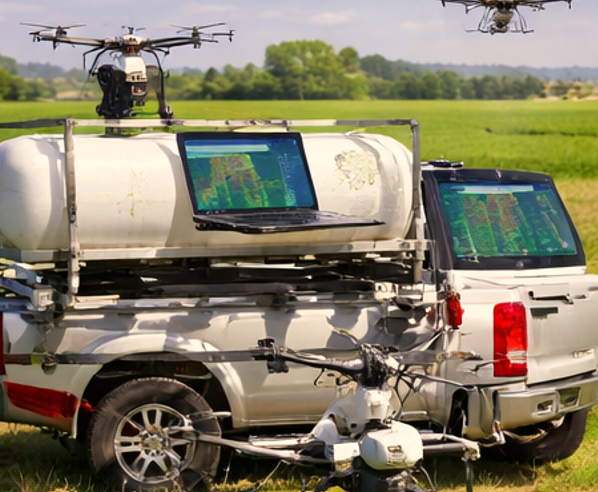
We know that in the modern era the agriculture is rapidly evolving as farmers adopt digital technologies to improve productivity, reduce input costs, and manage crops more efficiently. Over the past decade, Agricultural Drone Technology has become one of the most influential innovations in precision farming.
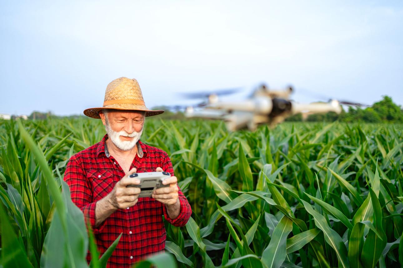
Instead of relying solely on tractors, manual scouting, and ground spraying equipment, farmers now use drones to inspect crops, apply fertilizers and pesticides, and create detailed aerial maps of their fields. These aerial tools allow farmers to detect crop stress early, optimize chemical usage, and make data-driven decisions.
However, one of the most common questions farmers ask is simple: how much do agricultural drone services actually cost?
The answer depends on several factors such as farm size, type of service, equipment used, and local regulations. Understanding these cost components helps farmers determine whether hiring Agricultural Drone Services can improve both efficiency and profitability.
Agricultural Drone Service Cost Tables
Average Cost of Agricultural Drone Services (Per Acre)
| Service Type | Average Cost per Acre | Typical Farm Size | What the Service Includes |
|---|---|---|---|
| Drone Crop Spraying | $10 – $25 | 20 – 500+ acres | Pesticide or fertilizer spraying using automated drone systems |
| Drone Mapping | $5 – $15 | 50 – 2,000 acres | High-resolution aerial mapping and field analysis |
| Multispectral Crop Analysis | $12 – $30 | 50 – 1,500 acres | Crop health monitoring using specialized sensors |
| Plant Health Monitoring | $8 – $20 | 30 – 1,000 acres | NDVI imaging to detect plant stress and diseases |
| Irrigation Mapping | $6 – $18 | 50 – 2,000 acres | Soil moisture and irrigation pattern analysis |
These prices vary depending on terrain complexity, crop type, and location.
Popular Agricultural Drones and Their Prices
| Drone Model | Manufacturer | Primary Use | Tank Capacity | Estimated Price |
|---|---|---|---|---|
| DJI Agras T50 | DJI | Crop spraying | 40 L | $18,000 – $22,000 |
| DJI Agras T40 | DJI | Precision spraying | 40 L | $16,000 – $20,000 |
| DJI Agras T30 | DJI | Large field spraying | 30 L | $14,000 – $18,000 |
| DJI Mavic 3 Multispectral | DJI | Crop health analysis | N/A | $5,000 – $6,000 |
| senseFly eBee X | AgEagle | Agricultural mapping | N/A | $20,000 – $25,000 |
| Parrot Bluegrass Fields | Parrot | Multispectral crop monitoring | N/A | $6,000 – $7,000 |
These drones are commonly used by companies offering Agricultural Drone Services across the United States.
Operational Cost of Owning an Agricultural Drone
| Expense Category | Average Annual Cost | Description |
|---|---|---|
| Drone Purchase | $10,000 – $35,000 | Initial equipment investment |
| Batteries & Charging Systems | $1,500 – $5,000 | Multiple batteries required for field operations |
| Maintenance & Repairs | $1,000 – $3,000 | Motors, propellers, sensors |
| Software & Data Analysis | $500 – $2,000 | Mapping and crop analysis software |
| Operator Training | $500 – $1,500 | Drone pilot certification and training |
This is why many farmers prefer hiring drone service providers instead of buying drones.
Cost Comparison: Traditional Spraying vs Drone Spraying
| Method | Average Cost per Acre | Labor Required | Chemical Waste | Field Damage |
|---|---|---|---|---|
| Tractor Spraying | $15 – $30 | High | Medium | Possible crop damage |
| Manual Spraying | $20 – $40 | Very High | High | Low |
| Drone Spraying | $10 – $25 | Low | Very Low | None |
Drone spraying often reduces pesticide usage by 20–30%.
Agricultural Drone Market Growth Statistics
| Year | Global Market Size | Growth Rate |
|---|---|---|
| 2022 | $3.7 Billion | — |
| 2023 | $4.9 Billion | 32% |
| 2024 | $6.3 Billion | 28% |
| 2025 | $8.4 Billion | 33% |
| 2026 (Estimated) | $11+ Billion | 30% |
This rapid growth is driven by increasing adoption of Precision Agriculture technologies.
Farm Coverage Capacity of Agricultural Drones
| Drone Type | Coverage Per Hour | Coverage Per Day |
|---|---|---|
| Crop Spraying Drone | 20 – 40 acres | 120 – 200 acres |
| Mapping Drone | 200 – 400 acres | 1,500+ acres |
| Multispectral Drone | 100 – 300 acres | 800 – 1,200 acres |
Large farms typically use multiple drones or service providers to complete operations faster.
Example Cost Calculation for a 500-Acre Farm
| Service | Rate per Acre | Total Cost |
|---|---|---|
| Drone Crop Spraying | $15 | $7,500 |
| Drone Mapping | $8 | $4,000 |
| Crop Health Monitoring | $10 | $5,000 |
| Total Seasonal Cost | — | $16,500 |
Despite these costs, farmers often save more through reduced chemicals, labor, and improved yields.
How Agricultural Drone Technology Works
Agricultural drones operate using a combination of flight automation, advanced sensors, and precision application systems designed specifically for farming environments.
GPS Flight Automation
Modern agricultural drones follow pre-programmed flight paths using satellite navigation. Before launching a drone, operators create a digital map of the farm and define specific routes. The drone then flies automatically across the field while maintaining consistent altitude and coverage.
This automation ensures that every section of the farm is scanned or sprayed evenly.
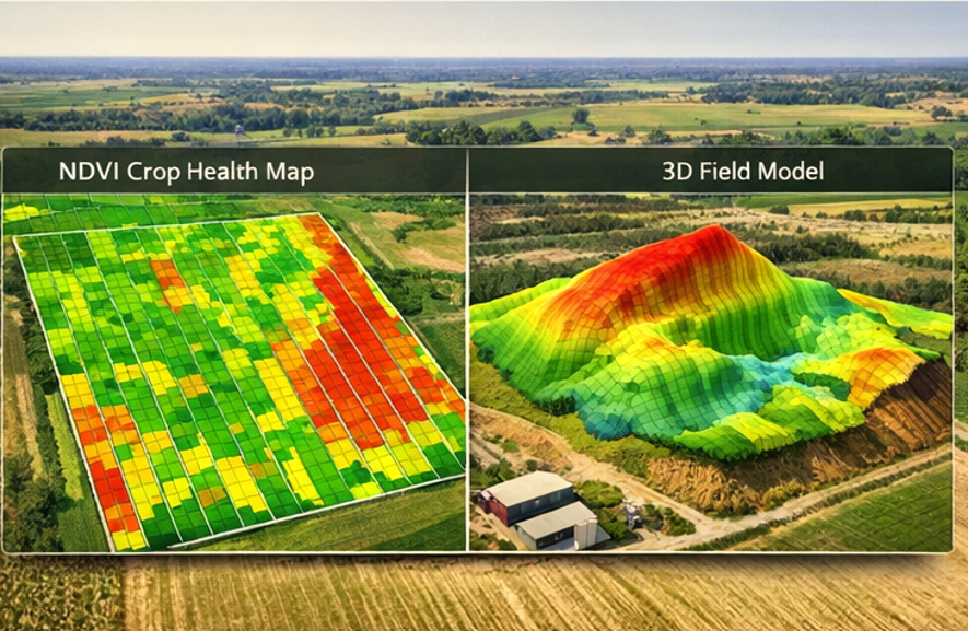
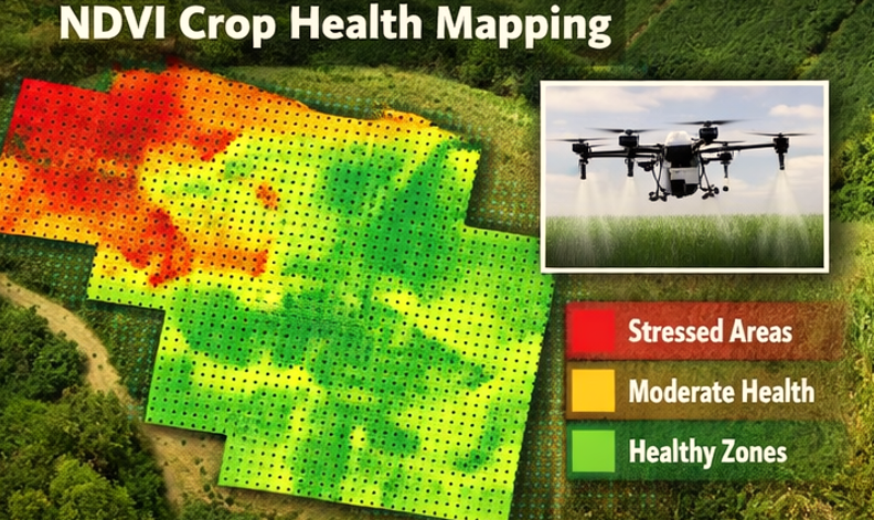
Crop Monitoring Sensors
Many drones are equipped with multispectral cameras that capture light wavelengths invisible to the human eye. These sensors measure plant health by analyzing how crops reflect sunlight.
Healthy plants reflect light differently than stressed plants. By analyzing this data, farmers can identify areas with disease, nutrient deficiency, or water stress long before visible symptoms appear.
Precision Spraying Systems
Spraying drones carry liquid tanks and specialized nozzles that distribute pesticides or fertilizers evenly across crops. Advanced drones adjust spray flow automatically depending on flight speed and crop density.
This targeted approach significantly reduces chemical waste.
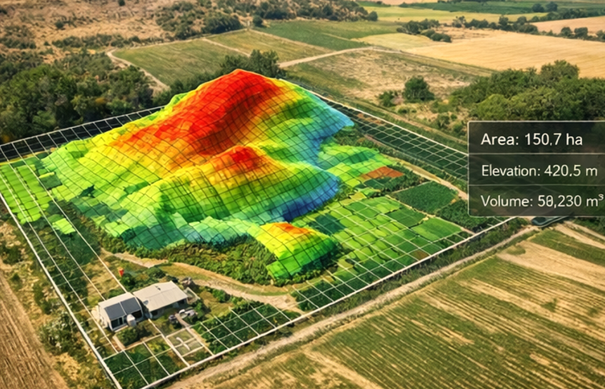
Aerial Mapping Tools
Mapping drones capture hundreds of high-resolution images during flight. Software then stitches these images into detailed farm maps used for crop analysis, irrigation planning, and yield forecasting.
Many farmers rely on Drone Mapping Services to monitor crop performance throughout the growing season.
Types of Agricultural Drones
Different types of drones are designed for specific farming tasks. Understanding these categories helps farmers choose the most appropriate service.
Crop Spraying Drones
These drones carry liquid tanks ranging from 10 to 70 liters depending on the model. They are designed to spray pesticides, fungicides, or fertilizers efficiently across fields.
Because they fly low and maintain consistent speed, Crop Spraying Drones can provide extremely uniform coverage compared to manual spraying.
Aerial Mapping Drones
Mapping drones focus on data collection rather than chemical application. They typically carry high-resolution cameras or multispectral sensors that capture detailed images of farmland.
Farmers often use mapping data to identify crop stress zones and guide variable-rate fertilizer applications.
Multispectral Imaging Drones
These advanced drones capture specialized crop health data using multiple light bands. They are particularly useful for detecting plant diseases early and evaluating nutrient levels.
Large commercial farms frequently combine multispectral imaging with Precision Agriculture software platforms.
Real Farming Applications
Agricultural drones are used in many practical farming scenarios where timely information and precise input management are essential.
Early Crop Disease Detection
Plant diseases often begin in small sections of a field. Traditional scouting may miss these early signs because they are difficult to see from ground level.
Drone imagery can highlight stressed crop areas quickly, allowing farmers to treat affected zones before disease spreads.
Precision Pesticide Application
Instead of spraying an entire field uniformly, drones allow targeted pesticide application. If only certain sections show pest damage, drones can treat those areas while leaving healthy crops untouched.
This method reduces both chemical usage and environmental impact.
Irrigation Planning
Drone mapping helps farmers analyze soil moisture patterns and identify areas where irrigation systems may not distribute water evenly.
Farmers can then adjust irrigation schedules or repair equipment to maintain consistent crop growth.
Benefits for Farmers
Using drones in agriculture offers several advantages that can improve farm management and profitability.
Reduced Chemical Usage
Because drones apply pesticides and fertilizers with high precision, farmers often use less chemical product overall. Lower chemical usage reduces costs and minimizes environmental impact.
Faster Field Coverage
Large farms can be difficult to monitor manually. Drones can inspect hundreds of acres in a single flight session, providing rapid insights about crop conditions.
Improved Crop Monitoring
Regular aerial monitoring allows farmers to track crop development throughout the growing season. Early detection of problems helps prevent yield loss.
Many farms now rely on professional Agricultural Drone Services to perform these monitoring tasks regularly.
Limitations and Challenges
Despite their advantages, agricultural drones also have practical limitations that farmers should consider.
Weather Conditions
Strong winds, rain, or fog can prevent safe drone operation. Weather conditions may delay scheduled flights during critical farming periods.
Battery Limitations
Most agricultural drones can fly between 15 and 30 minutes per battery. Large farms often require multiple flights or battery swaps to complete a mission.
Training Requirements
Drone operators must understand both flight safety and agricultural data interpretation. Many countries also require certification for commercial drone operation.
Hiring professional service providers can help farmers avoid these training challenges.
Costs and Efficiency
The cost of agricultural drone services varies depending on several factors, including farm size, service type, and geographic region.
Mapping Services
Drone mapping services typically charge between $5 and $15 per acre depending on image resolution and analysis requirements.
Large farms may receive discounted rates due to the scale of operations.
Crop Spraying Services
Drone spraying services generally cost between $10 and $25 per acre. Pricing may increase depending on terrain difficulty, crop type, or chemical payload requirements.
However, these costs often replace traditional ground spraying equipment and labor.
Equipment Ownership Costs
Some farmers choose to purchase drones instead of hiring service providers. Professional agricultural drones may cost between $10,000 and $35,000 depending on capabilities.
Additional costs include:
• batteries and charging systems
• maintenance and repairs
• operator training
• software subscriptions
For many farms, outsourcing through Crop Spraying Drone Services can be more economical than purchasing equipment outright.
Future of Agricultural Drone Technology
The agricultural drone industry continues to evolve as new technologies emerge.
AI-Powered Crop Analysis
Artificial intelligence is improving the ability of drones to analyze crop imagery automatically. AI systems can identify disease patterns, pest damage, and nutrient deficiencies without manual interpretation.
Autonomous Drone Fleets
Future farms may operate multiple drones simultaneously using centralized software. These drone fleets could automatically scan fields, apply treatments, and upload data to farm management systems.
Integration with Smart Farming Platforms
Agricultural drones are increasingly connected with digital farm management tools that track planting schedules, weather patterns, and crop yields.
This integration helps farmers make more accurate decisions based on real-time field data.
How Farmers Can Find Reliable Drone Services
Farmers interested in drone technology often begin by hiring experienced service providers rather than purchasing equipment immediately.
Professional drone operators provide services such as crop spraying, aerial mapping, and crop health analysis. These providers typically have licensed pilots, specialized equipment, and data analysis tools.
Many farmers search online directories to compare available providers offering Agricultural Drone Services in their region. Reviewing service options, experience levels, and equipment capabilities helps farmers select reliable partners.
Frequently Asked Questions
How accurate are agricultural drones
Agricultural drones can capture images with centimeter-level accuracy when using GPS and ground control points. This level of precision allows farmers to identify crop stress zones and manage fields more effectively.
Are drone spraying services expensive
Drone spraying services usually cost between $10 and $25 per acre depending on farm conditions and service providers. Many farmers find that reduced chemical usage offsets these costs.
Can drones detect crop diseases
Yes. Multispectral sensors can detect plant stress caused by diseases before visible symptoms appear. Early detection helps farmers treat affected areas quickly.
Do farmers need licenses to use drones
In the United States, commercial drone operators must follow aviation regulations and hold proper certifications. Farmers often hire licensed operators to ensure compliance.
How large of a farm can a drone cover
A single drone can typically cover 40 to 150 acres per day depending on mission type, battery capacity, and terrain conditions.
Leave a Reply